 |
|
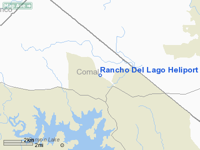
Location & QuickFacts
| FAA Information Effective: | 2008-09-25 |
| Airport Identifier: | 08TA |
| Airport Status: | Operational |
| Longitude/Latitude: | 098-13-28.0430W/29-57-06.7730N
-98.224456/29.951881 (Estimated) |
| Elevation: | 1208 ft / 368.20 m (Estimated) |
| Land: | 0 acres |
| From nearest city: | 3 nautical miles SE of Fischer, TX |
| Location: | Comal County, TX |
| Magnetic Variation: | 07E (1985) |
Owner & Manager
| Ownership: | Privately owned |
| Owner: | Lee R Roper |
| Address: | Blanco Star Route 55
San Marcos, TX 78666 |
| Phone number: | 512-935-2444 |
| Manager: | Ed Goldbranson |
| Address: | Blanco Star Route 55
San Marcos, TX 78666 |
| Phone number: | 512-935-2444 |
Airport Operations and Facilities
| Airport Use: | Private |
| Wind indicator: | Yes |
| Segmented Circle: | No |
| Control Tower: | No |
| Landing fee charge: | No |
| Sectional chart: | San Antonio |
| Region: | ASW - Southwest |
| Boundary ARTCC: | ZHU - Houston |
| Tie-in FSS: | SJT - San Angelo |
| FSS on Airport: | No |
| FSS Toll Free: | 1-800-WX-BRIEF |
Runway Information
Helipad H1
| Dimension: | 200 x 100 ft / 61.0 x 30.5 m |
| Surface: | TURF, |
| |
Runway H1 |
Runway |
| Traffic Pattern: | Left | Left |
|
Radio Navigation Aids
| ID |
Type |
Name |
Ch |
Freq |
Var |
Dist |
| MFS | NDB | Horseshoe Bay Resort | | 403.00 | 07E | 35.0 nm |
| ER | NDB | Shein | | 263.00 | 08E | 40.9 nm |
| BMQ | NDB | Burnet | | 341.00 | 07E | 47.4 nm |
| CVB | NDB | Castroville | | 338.00 | 08E | 48.9 nm |
| DHK | TACAN | Randolph | 036X | | 09E | 25.0 nm |
| KSY | TACAN | Kelly | 057X | | 07E | 38.5 nm |
| SSF | VOR | Stinson | | 108.40 | 09E | 43.2 nm |
| SAT | VORTAC | San Antonio | 115X | 116.80 | 08E | 22.2 nm |
| RND | VORTAC | Randolph | 70X | 112.30 | 09E | 26.2 nm |
| STV | VORTAC | Stonewall | 085X | 113.80 | 08E | 29.3 nm |
| CWK | VORTAC | Centex | 075X | 112.80 | 06E | 44.3 nm |
| SAT | VOT | San Antonio Intl | | 110.40 | | 28.2 nm |
Images and information placed above are from
http://www.airport-data.com/airport/08TA/
We thank them for the data!
| General Info
|
| Country |
United States
|
| State |
TEXAS
|
| FAA ID |
08TA
|
| Latitude |
29-57-06.773N
|
| Longitude |
098-13-28.043W
|
| Elevation |
1208 feet
|
| Near City |
FISCHER
|
We don't guarantee the information is fresh and accurate. The data may
be wrong or outdated.
For more up-to-date information please refer to other sources.
|
|


