 |
|
Location & QuickFacts
| FAA Information Effective: | 2008-09-25 |
| Airport Identifier: | 83TA |
| Airport Status: | Operational |
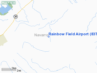
| Longitude/Latitude: | 096-36-01.0000W/31-54-01.0000N
-96.600278/31.900278 (Estimated) |
| Elevation: | 365 ft / 111.25 m (Estimated) |
| Land: | 0 acres |
| From nearest city: | 4 nautical miles SE of Purdon, TX |
| Location: | Navarro County, TX |
| Magnetic Variation: | 06E (1990) |
Owner & Manager
| Ownership: | Privately owned |
| Owner: | Joe Bart Aviation |
| Address: | P.o. Box 2051
Corsicana, TX 75110 |
| Phone number: | 214-874-7623 |
| Manager: | Joe Beauchamp |
| Address: | P.o. Box 2051
Corsicana, TX 75110 |
| Phone number: | 214-874-7623 |
Airport Operations and Facilities
| Airport Use: | Private |
| Segmented Circle: | No |
| Control Tower: | No |
| Sectional chart: | Houston |
| Region: | ASW - Southwest |
| Boundary ARTCC: | ZFW - Fort Worth |
| Tie-in FSS: | FTW - Fort Worth |
| FSS on Airport: | No |
| FSS Phone: | 817-541-3474 |
| FSS Toll Free: | 1-800-WX-BRIEF |
Runway Information
Runway 14/32
| Dimension: | 3900 x 150 ft / 1188.7 x 45.7 m |
| Surface: | TURF, |
| |
Runway 14 |
Runway 32 |
| Traffic Pattern: | Left | Left |
|
Radio Navigation Aids
| ID |
Type |
Name |
Ch |
Freq |
Var |
Dist |
| CRS | NDB | Corsicana | | 396.00 | 06E | 13.0 nm |
| CGQ | NDB | Powell | | 344.00 | 06E | 13.2 nm |
| LXY | NDB | Mexia | | 329.00 | 07E | 16.3 nm |
| PYF | NDB | Pyramid | | 418.00 | 06E | 20.7 nm |
| LIQ | NDB | Lochridge Ranch | | 335.00 | 09E | 33.7 nm |
| ROB | NDB | Robinson | | 400.00 | 07E | 33.8 nm |
| CSZ | NDB | Crossroads | | 215.00 | 08E | 34.2 nm |
| LNC | NDB | Lancaster | | 239.00 | 06E | 41.2 nm |
| AHX | NDB | Athens | | 269.00 | 06E | 42.2 nm |
| XQH | NDB | Cedar Hill | | 353.00 | 08E | 45.7 nm |
| JUG | NDB | Jecca | | 388.00 | 06E | 46.3 nm |
| PSN | NDB | Palestine | | 375.00 | 04E | 46.5 nm |
| RBD | NDB | Redbird | | 287.00 | 06E | 48.7 nm |
| GNL | VOR/DME | Groesbeck | 025X | 108.80 | 05E | 19.3 nm |
| CQY | VORTAC | Cedar Creek | 095X | 114.80 | 06E | 26.0 nm |
| ACT | VORTAC | Waco | 100X | 115.30 | 09E | 37.0 nm |
Images and information placed above are from
http://www.airport-data.com/airport/83TA/
We thank them for the data!
| General Info
|
| Country |
United States
|
| State |
TEXAS
|
| FAA ID |
83TA
|
| Latitude |
31-54-01.000N
|
| Longitude |
096-36-01.000W
|
| Elevation |
365 feet
|
| Near City |
PURDON
|
We don't guarantee the information is fresh and accurate. The data may
be wrong or outdated.
For more up-to-date information please refer to other sources.
|
|


