 |
|
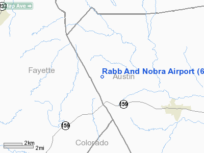
Location & QuickFacts
| FAA Information Effective: | 2008-09-25 |
| Airport Identifier: | 6TS8 |
| Airport Status: | Operational |
| Longitude/Latitude: | 096-34-52.0000W/30-00-12.0000N
-96.581111/30.003333 (Estimated) |
| Elevation: | 400 ft / 121.92 m (Estimated) |
| Land: | 0 acres |
| From nearest city: | 4 nautical miles SE of Industry, TX |
| Location: | Austin County, TX |
| Magnetic Variation: | () |
Owner & Manager
| Ownership: | Privately owned |
| Owner: | Thomas V. Rabb Jr |
| Address: | 2546 Krebs Rd.
Fayetteville, TX 78940 |
| Phone number: | 979-249-3988 |
| Manager: | Thomas V. Rabb Jr |
| Address: | 2546 Krebs Rd.
Fayetteville, TX 78940 |
| Phone number: | 979-249-3988 |
Airport Operations and Facilities
| Airport Use: | Private |
| Control Tower: | No |
| Sectional chart: | Houston |
| Region: | ASW - Southwest |
| Boundary ARTCC: | ZHU - Houston |
| Tie-in FSS: | CXO - Montgomery County |
| FSS Toll Free: | 1-800-WX-BRIEF |
Runway Information
Runway 02/20
| Dimension: | 2300 x 30 ft / 701.0 x 9.1 m |
| Surface: | TURF, |
| |
Runway 02 |
Runway 20 |
| Traffic Pattern: | Left | Left |
| Displaced threshold: | 0.00 ft | 200.00 ft |
| Obstruction: | | 30 ft trees, 100.0 ft from runway |
|
Radio Navigation Aids
| ID |
Type |
Name |
Ch |
Freq |
Var |
Dist |
| BNH | NDB | Brenham | | 362.00 | 06E | 17.0 nm |
| GYB | NDB | Lee County | | 385.00 | 07E | 23.0 nm |
| LYD | NDB | Lakeside | | 249.00 | 05E | 48.4 nm |
| EYQ | NDB | Weiser | | 286.00 | 06E | 49.1 nm |
| ELA | VOR/DME | Eagle Lake | 111X | 116.40 | 08E | 24.7 nm |
| IDU | VORTAC | Industry | 039X | 110.20 | 08E | 3.0 nm |
| TNV | VORTAC | Navasota | 106X | 115.90 | 08E | 32.1 nm |
| CLL | VORTAC | College Station | 080X | 113.30 | 08E | 37.1 nm |
Remarks
- 33 FT TWR 2 NM NW; 439 FT TWR 6 NM SE; 455 FT TWR 4 NM SW; 312 FT TWR 4 NM NE OF ARPT.
- PRVDD VFR OPNS AND CLEAR 20:1 APCHS.
Images and information placed above are from
http://www.airport-data.com/airport/6TS8/
We thank them for the data!
| General Info
|
| Country |
United States
|
| State |
TEXAS
|
| FAA ID |
6TS8
|
| Latitude |
32-13-30.533N
|
| Longitude |
097-18-41.050W
|
| Elevation |
800 feet
|
| Near City |
PARKER
|
We don't guarantee the information is fresh and accurate. The data may
be wrong or outdated.
For more up-to-date information please refer to other sources.
|
|


