 |
|
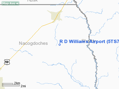
Location & QuickFacts
| FAA Information Effective: | 2008-09-25 |
| Airport Identifier: | 5TS7 |
| Airport Status: | Operational |
| Longitude/Latitude: | 094-29-07.7410W/31-46-35.6310N
-94.485484/31.776564 (Estimated) |
| Elevation: | 360 ft / 109.73 m (Estimated) |
| Land: | 75 acres |
| From nearest city: | 3 nautical miles S of Garrison, TX |
| Location: | Nacogdoches County, TX |
| Magnetic Variation: | 07E (1985) |
Owner & Manager
| Ownership: | Privately owned |
| Owner: | R. D. Williams |
| Address: | Rt 3, Box 281
Garrison, TX 75946 |
| Phone number: | 409-347-2652 |
| Manager: | R. D. Williams |
| Address: | Rt 3, Box 281
Garrison, TX 75946 |
| Phone number: | 409-347-2652 |
Airport Operations and Facilities
| Airport Use: | Private |
| Wind indicator: | Yes |
| Segmented Circle: | No |
| Control Tower: | No |
| Sectional chart: | Houston |
| Region: | ASW - Southwest |
| Boundary ARTCC: | ZFW - Fort Worth |
| Tie-in FSS: | CXO - Montgomery County |
| FSS on Airport: | No |
| FSS Toll Free: | 1-800-WX-BRIEF
FOR FP FILING CALL CXO FSS 1-800-833-5602. |
Runway Information
Runway 18/36
| Dimension: | 2500 x 60 ft / 762.0 x 18.3 m |
| Surface: | TURF, |
| |
Runway 18 |
Runway 36 |
| Traffic Pattern: | Left | Left |
| Obstruction: | 50 ft trees, 500.0 ft from runway | |
|
Radio Navigation Aids
| ID |
Type |
Name |
Ch |
Freq |
Var |
Dist |
| GXD | NDB | Nacogdoches | | 391.00 | 05E | 13.6 nm |
| CZJ | NDB | Amason | | 341.00 | 04E | 17.3 nm |
| OC | NDB | Nados | | 253.00 | 05E | 21.2 nm |
| RPF | NDB | Carthage | | 332.00 | 04E | 26.1 nm |
| HNO | NDB | Henderson | | 371.00 | 06E | 31.3 nm |
| JSO | NDB | Cherokee County | | 263.00 | 05E | 37.7 nm |
| MSD | NDB | Mansfield | | 414.00 | 04E | 40.6 nm |
| MMY | NDB | Many | | 272.00 | 04E | 49.8 nm |
| LFK | VORTAC | Lufkin | 058X | 112.10 | 05E | 38.8 nm |
| GGG | VORTAC | Gregg County | 070X | 112.30 | 07E | 40.9 nm |
Remarks
- PRVDD THRS ARE DSPLCD TO PRVD 20:1 APCH SLOPES.
Images and information placed above are from
http://www.airport-data.com/airport/5TS7/
We thank them for the data!
| General Info
|
| Country |
United States
|
| State |
TEXAS
|
| FAA ID |
5TS7
|
| Latitude |
31-46-35.631N
|
| Longitude |
094-29-07.741W
|
| Elevation |
360 feet
|
| Near City |
GARRISON
|
We don't guarantee the information is fresh and accurate. The data may
be wrong or outdated.
For more up-to-date information please refer to other sources.
|
|


