 |
|
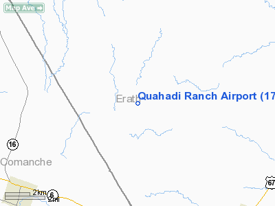
Location & QuickFacts
| FAA Information Effective: | 2008-09-25 |
| Airport Identifier: | 17XS |
| Airport Status: | Operational |
| Longitude/Latitude: | 098-26-06.0000W/32-10-40.0000N
-98.435000/32.177778 (Estimated) |
| Elevation: | 1422 ft / 433.43 m (Estimated) |
| Land: | 50 acres |
| From nearest city: | 7 nautical miles W of Dublin, TX |
| Location: | Erath County, TX |
| Magnetic Variation: | 06E (2005) |
Owner & Manager
| Ownership: | Privately owned |
| Owner: | Smith-family Trust No. 1 |
| Address: | 4033 Grassmere Lane
Dallas, TX 75205 |
| Phone number: | 214-979-7640 |
| Manager: | Stephen B. Smith |
| Address: | 4033 Grassmere Lane
Dallas, TX 75205 |
| Phone number: | 214-979-7640 |
Airport Operations and Facilities
| Airport Use: | Private |
| Wind indicator: | Yes |
| Segmented Circle: | No |
| Control Tower: | No |
| Lighting Schedule: | RDO-CTL
ACTVT ROTG BCN - 121.6. |
| Beacon Color: | Clear-Green (lighted land airport) |
| Sectional chart: | Dallas-ft Worth |
| Region: | ASW - Southwest |
| Boundary ARTCC: | ZFW - Fort Worth |
| Tie-in FSS: | FTW - Fort Worth |
| FSS Phone: | 817-541-3474 |
| FSS Toll Free: | 1-800-WX-BRIEF |
Runway Information
Runway 01/19
| Dimension: | 6295 x 80 ft / 1918.7 x 24.4 m |
| Surface: | ASPH, Good Condition |
| Edge Lights: | Medium |
| |
Runway 01 |
Runway 19 |
| Longitude: | 098-26-18.8480W | 098-25-53.5120W |
| Latitude: | 32-10-10.7210N | 32-11-09.1730N |
| Elevation: | 1313.00 ft | 1422.00 ft |
| Traffic Pattern: | Left | Left |
| Markings: | Basic, | Basic, |
| Displaced threshold: | 370.00 ft | 0.00 ft |
|
Radio Navigation Aids
| ID |
Type |
Name |
Ch |
Freq |
Var |
Dist |
| OIP | NDB | Old Rip | | 410.00 | 07E | 23.2 nm |
| MNZ | NDB | Hamilton | | 251.00 | 07E | 36.6 nm |
| MWL | NDB | Mineral Wells | | 266.00 | 06E | 41.2 nm |
| BKD | NDB | Breckenridge | | 245.00 | 07E | 41.3 nm |
| GZV | NDB | Brazos River | | 280.00 | 07E | 46.5 nm |
| BWD | VOR/DME | Brownwood | 023X | 108.60 | 08E | 31.7 nm |
| JEN | VORTAC | Glen Rose | 097X | 115.00 | 06E | 28.4 nm |
| MQP | VORTAC | Millsap | 124X | 117.70 | 09E | 39.7 nm |
Remarks
- PRVDD ARPT LOCATION DEPICTED ON MAP VERIFIED.
Images and information placed above are from
http://www.airport-data.com/airport/17XS/
We thank them for the data!
| General Info
|
| Country |
United States
|
| State |
TEXAS
|
| FAA ID |
17XS
|
| Latitude |
32.177778
32° 10' 40.00" N
|
| Longitude |
-98.435000
098° 26' 06.00" W
|
| Elevation |
1422 feet
433 meters
|
| Magnetic Variation |
005° E (01/06)
|
| Beacon |
Yes
|
| Operating Agency |
PRIVATE
|
We don't guarantee the information is fresh and accurate. The data may
be wrong or outdated.
For more up-to-date information please refer to other sources.
|
|


