 |
|
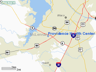
Providence Health Center Heliport |
Location & QuickFacts
| FAA Information Effective: | 2008-09-25 |
| Airport Identifier: | 7TX1 |
| Airport Status: | Operational |
| Longitude/Latitude: | 097-12-01.0190W/31-30-50.5990N
-97.200283/31.514055 (Estimated) |
| Elevation: | 612 ft / 186.54 m (Estimated) |
| Land: | 0 acres |
| From nearest city: | 5 nautical miles NE of Waco, TX |
| Location: | Mc Lennan County, TX |
| Magnetic Variation: | 07E (1985) |
Owner & Manager
| Ownership: | Privately owned |
| Owner: | Providence Health Center |
| Address: | 6901 Medical Parkway
Waco, TX 76712 |
| Phone number: | 817-751-4000 |
| Address: |
|
Airport Operations and Facilities
| Airport Use: | Private
MEDICAL. |
| Wind indicator: | Yes |
| Segmented Circle: | No |
| Control Tower: | No |
| Sectional chart: | San Antonio |
| Region: | ASW - Southwest |
| Boundary ARTCC: | ZFW - Fort Worth |
| Tie-in FSS: | FTW - Fort Worth |
| FSS on Airport: | No |
| FSS Phone: | 817-541-3474 |
| FSS Toll Free: | 1-800-WX-BRIEF |
Runway Information
Helipad H1
| Dimension: | 60 x 60 ft / 18.3 x 18.3 m |
| Surface: | ASPH, |
| |
Runway H1 |
Runway |
| Traffic Pattern: | Left | Left |
|
Radio Navigation Aids
| ID |
Type |
Name |
Ch |
Freq |
Var |
Dist |
| ROB | NDB | Robinson | | 400.00 | 07E | 6.7 nm |
| HLR | NDB | Hood | | 347.00 | 07E | 35.0 nm |
| LXY | NDB | Mexia | | 329.00 | 07E | 36.0 nm |
| IL | NDB | Iresh | | 278.00 | 07E | 39.3 nm |
| GR | NDB | Starn | | 323.00 | 07E | 40.6 nm |
| MNZ | NDB | Hamilton | | 251.00 | 07E | 48.9 nm |
| TPL | VOR/DME | Temple | 041X | 110.40 | 09E | 21.6 nm |
| GNL | VOR/DME | Groesbeck | 025X | 108.80 | 05E | 33.6 nm |
| GRK | VOR/DME | Gray | 055X | 111.80 | 07E | 42.8 nm |
| ACT | VORTAC | Waco | 100X | 115.30 | 09E | 9.6 nm |
Remarks
- PRVDD A SATISFACTORY SAFETY INSPECTION IS CONDUCTED AFTER CONSTRUCTION BUT PRIOR TO ACTIVATION.
Images and information placed above are from
http://www.airport-data.com/airport/7TX1/
We thank them for the data!
| General Info
|
| Country |
United States
|
| State |
TEXAS
|
| FAA ID |
7TX1
|
| Latitude |
31-30-50.599N
|
| Longitude |
097-12-01.019W
|
| Elevation |
612 feet
|
| Near City |
WACO
|
We don't guarantee the information is fresh and accurate. The data may
be wrong or outdated.
For more up-to-date information please refer to other sources.
|
|


