 |
|
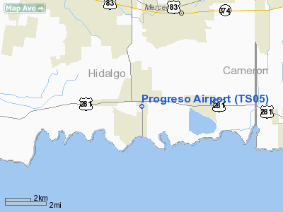
Location & QuickFacts
| FAA Information Effective: | 2008-09-25 |
| Airport Identifier: | TS05 |
| Airport Status: | Operational |
| Longitude/Latitude: | 097-57-01.0060W/26-05-01.2770N
-97.950279/26.083688 (Estimated) |
| Elevation: | 70 ft / 21.34 m (Estimated) |
| Land: | 25 acres |
| From nearest city: | 1 nautical miles E of Progreso, TX |
| Location: | Hidalgo County, TX |
| Magnetic Variation: | 07E (1985) |
Owner & Manager
| Ownership: | Privately owned |
| Owner: | U.s. Customs |
| Address: | 1 Mi. E Military & F.m. 1015
Progreso, TX 78579 |
| Phone number: | 512-585-6641 |
| Manager: | Nelson Copine |
| Address: | P.o. Box 88
Progreso, TX 78579 |
| Phone number: | 512-585-6641 |
Airport Operations and Facilities
| Airport Use: | Private |
| Wind indicator: | Yes |
| Segmented Circle: | No |
| Control Tower: | No |
| Landing fee charge: | No |
| Sectional chart: | Brownsville |
| Region: | ASW - Southwest |
| Boundary ARTCC: | ZHU - Houston |
| Tie-in FSS: | SJT - San Angelo |
| FSS on Airport: | No |
| FSS Toll Free: | 1-800-WX-BRIEF |
Airport Services
| Airframe Repair: | MAJOR |
| Power Plant Repair: | MAJOR |
Runway Information
Runway 17/35
| Dimension: | 4470 x 20 ft / 1362.5 x 6.1 m |
| Surface: | ASPH, Good Condition |
| Weight Limit: | Single wheel: 4000 lbs. |
| |
Runway 17 |
Runway 35 |
| Traffic Pattern: | Left | Left |
| Obstruction: | 7 ft fence, 50 ft right of centerline
7' FENCE 50' R & 75' L AT THR. | , 50:1 slope to clear
GRVL RD 90' FM THR ACROSS APCH. |
|
Radio Navigation Aids
| ID |
Type |
Name |
Ch |
Freq |
Var |
Dist |
| REX | VOR | Reynosa | | 112.40 | 08E | 15.7 nm |
| MFE | VOR/DME | Mc Allen | 119X | 117.20 | 09E | 16.6 nm |
| HRL | VOR/DME | Harlingen | 029X | 109.20 | 05E | 18.3 nm |
| MAM | VOR/DME | Matamoros | 090X | 114.30 | 07E | 29.7 nm |
| BRO | VORTAC | Brownsville | 110X | 116.30 | 09E | 32.5 nm |
Remarks
- -15' DITCH 75' FM RY CNTRLN ALG WEST EDGE OF RY.
- PRVDD LNDG THRS ARE LOCATED OR DSPLCD TO PROVIDE APPROACH CLEARANCE OF 20:1.
Images and information placed above are from
http://www.airport-data.com/airport/TS05/
We thank them for the data!
| General Info
|
| Country |
United States
|
| State |
TEXAS
|
| FAA ID |
TS05
|
| Latitude |
26-05-01.277N
|
| Longitude |
097-57-01.006W
|
| Elevation |
70 feet
|
| Near City |
PROGRESO
|
We don't guarantee the information is fresh and accurate. The data may
be wrong or outdated.
For more up-to-date information please refer to other sources.
|
|


