 |
|
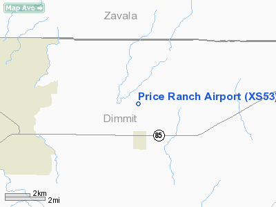
Location & QuickFacts
| FAA Information Effective: | 2008-09-25 |
| Airport Identifier: | XS53 |
| Airport Status: | Operational |
| Longitude/Latitude: | 099-34-17.1640W/28-35-45.9350N
-99.571434/28.596093 (Estimated) |
| Elevation: | 532 ft / 162.15 m (Estimated) |
| Land: | 0 acres |
| From nearest city: | 1 nautical miles N of Big Wells, TX |
| Location: | Dimmit County, TX |
| Magnetic Variation: | 07E (1990) |
Owner & Manager
| Ownership: | Privately owned |
| Owner: | Price Cattle Co |
| Address: | Box 1506
Uvalde, TX 78802 |
| Phone number: | 512-278-8082 |
| Manager: | Robert L. Price |
| Address: | Box 1506
Uvalde, TX 78802 |
| Phone number: | 512-457-2403 |
Airport Operations and Facilities
| Airport Use: | Private |
| Wind indicator: | Yes |
| Segmented Circle: | No |
| Control Tower: | No |
| Sectional chart: | San Antonio |
| Region: | ASW - Southwest |
| Boundary ARTCC: | ZHU - Houston |
| Tie-in FSS: | SJT - San Angelo |
| FSS on Airport: | No |
| FSS Toll Free: | 1-800-WX-BRIEF |
Runway Information
Runway 15/33
| Dimension: | 3200 x 80 ft / 975.4 x 24.4 m |
| Surface: | DIRT, |
| |
Runway 15 |
Runway 33 |
| Traffic Pattern: | Left | Left |
| Displaced threshold: | 400.00 ft | 200.00 ft |
| Obstruction: | 20 ft plines, 50.0 ft from runway | 10 ft trees, 10.0 ft from runway |
|
Radio Navigation Aids
| ID |
Type |
Name |
Ch |
Freq |
Var |
Dist |
| DMD | NDB | Dimmit County | | 343.00 | 07E | 14.2 nm |
| LKX | NDB | La Pryor | | 223.00 | 09E | 25.0 nm |
| CPZ | NDB | Chaparrosa Ranch | | 385.00 | 10E | 29.7 nm |
| UVA | NDB | Uvalde | | 281.00 | 07E | 35.9 nm |
| HHH | NDB | Devine | | 359.00 | 07E | 46.6 nm |
| HDO | VOR/DME | Hondo | 31X | 109.40 | 08E | 49.8 nm |
| COT | VORTAC | Cotulla | 105X | 115.80 | 09E | 25.2 nm |
Remarks
- PRVDD EXISTING (OLD) LOCATION IS ABNDD PRIOR TO ACTIVATION OF THE NEW ARPT.
Images and information placed above are from
http://www.airport-data.com/airport/XS53/
We thank them for the data!
| General Info
|
| Country |
United States
|
| State |
TEXAS
|
| FAA ID |
XS53
|
| Latitude |
28-35-45.935N
|
| Longitude |
099-34-17.164W
|
| Elevation |
532 feet
|
| Near City |
BIG WELLS
|
We don't guarantee the information is fresh and accurate. The data may
be wrong or outdated.
For more up-to-date information please refer to other sources.
|
|


