 |
|
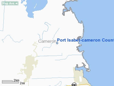
Port Isabel-cameron County Airport |
Location & QuickFacts
| FAA Information Effective: | 2008-09-25 |
| Airport Identifier: | PIL |
| Airport Status: | Operational |
| Longitude/Latitude: | 097-20-45.2000W/26-09-58.3000N
-97.345889/26.166194 (Estimated) |
| Elevation: | 19 ft / 5.79 m (Surveyed) |
| Land: | 826 acres |
| From nearest city: | 10 nautical miles NW of Port Isabel, TX |
| Location: | Cameron County, TX |
| Magnetic Variation: | 05E (2010) |
Owner & Manager
| Ownership: | Publicly owned |
| Owner: | Cameron County |
| Address: | County Courthouse, 964 E Harrison St
Brownsville, TX 78520 |
| Phone number: | 956-544-0830 |
| Manager: | Marty Pena |
| Address: | Cameron County Courthouse, 964 E Harrison St Rm 420
Brownsville, TX 78520 |
| Phone number: | 956-574-8767
ALSO 956-574-8771, OR FAX 956-574-8778. |
Airport Operations and Facilities
| Airport Use: | Open to public |
| Wind indicator: | Yes |
| Segmented Circle: | Yes |
| Control Tower: | No |
| Lighting Schedule: | DUSK-DAWN |
| Beacon Color: | Clear-Green (lighted land airport) |
| Landing fee charge: | No |
| Sectional chart: | Brownsville |
| Region: | ASW - Southwest |
| Traffic Pattern Alt: | 800 ft |
| Boundary ARTCC: | ZHU - Houston |
| Tie-in FSS: | SJT - San Angelo |
| FSS on Airport: | No |
| FSS Toll Free: | 1-800-WX-BRIEF |
| NOTAMs Facility: | PIL (NOTAM-d service avaliable) |
| Federal Agreements: | NPY |
Airport Communications
| CTAF: | 122.800 |
| Unicom: | 122.800 |
Airport Services
| Fuel available: | 100LLA |
| Airframe Repair: | MAJOR |
| Power Plant Repair: | MAJOR |
Runway Information
Runway 03/21
| Dimension: | 5000 x 150 ft / 1524.0 x 45.7 m |
| Surface: | ASPH-CONC, Fair Condition
RY PAVEMENT HAS HEAVY GRASS ENCROACHMENT.
ROUGH PAVEMENT. |
| Weight Limit: | Single wheel: 30000 lbs.
Dual wheel: 45000 lbs.
Dual tandem wheel: 90000 lbs. |
| |
Runway 03 |
Runway 21 |
| Longitude: | 097-21-17.9000W | 097-20-46.5445W |
| Latitude: | 26-09-43.0246N | 26-10-23.6636N |
| Elevation: | 13.00 ft | 12.00 ft |
| Alignment: | 35 | 127 |
| Traffic Pattern: | Left | Left |
| Markings: | Numbers only, Good Condition | Numbers only, Good Condition |
| Obstruction: | 12 ft brush, 630.0 ft from runway, 50 ft right of centerline, 35:1 slope to clear
+8 FT BRUSH AT THLD 75 FT LEFT AND RIGHT OF CENTERLINE. | 10 ft brush, 245.0 ft from runway, 4:1 slope to clear
+12 FT BRUSH AT THLD 95 FT L; 6 FT BRUSH AT THLD ACROSS APCH. |
|
Runway 08/26
| Dimension: | 5317 x 150 ft / 1620.6 x 45.7 m |
| Surface: | CONC, Poor Condition
RY PAVEMENT HAS HEAVY GRASS ENCROACHMENT.
ROUGH PAVEMENT. |
| Weight Limit: | Single wheel: 50000 lbs.
Dual wheel: 60000 lbs.
Dual tandem wheel: 110000 lbs. |
| |
Runway 08 |
Runway 26 |
| Longitude: | 097-21-14.9176W | 097-20-16.5629W |
| Latitude: | 26-09-48.9384N | 26-09-49.0785N |
| Elevation: | 13.00 ft | 17.00 ft |
| Alignment: | 90 | 127 |
| Traffic Pattern: | Left | Left |
| Markings: | Numbers only, Good Condition | Numbers only, Fair Condition |
| Obstruction: | , 50:1 slope to clear
+6 FT BRUSH AT THLD 100 FT LEFT CNTRLN & +4 FT HAY BALES AT 125 FT FROM THLD OB. | 22 ft tree, 560.0 ft from runway, 16:1 slope to clear |
|
Runway 13/31
| Dimension: | 8001 x 200 ft / 2438.7 x 61.0 m |
| Surface: | ASPH-CONC, Fair Condition
RY PAVEMENT HAS HEAVY GRASS ENCROACHMENT.
ROUGH PAVEMENT. |
| Weight Limit: | Single wheel: 105000 lbs.
Dual wheel: 135000 lbs.
Dual tandem wheel: 230000 lbs. |
| Edge Lights: | Medium |
| |
Runway 13 |
Runway 31 |
| Longitude: | 097-20-59.5342W | 097-19-57.2711W |
| Latitude: | 26-10-22.7265N | 26-09-26.8468N |
| Elevation: | 14.00 ft | 18.00 ft |
| Alignment: | 127 | 127 |
| Traffic Pattern: | Left | Left |
| Markings: | Non-precision instrument, Good Condition | Non-precision instrument, Good Condition |
| Crossing Height: | 28.00 ft | 40.00 ft |
| VASI: | 2-light PAPI on left side | 2-light PAPI on left side |
| Visual Glide Angle: | 2.00° | 3.00° |
| Runway End Identifier: | Yes | Yes |
| Obstruction: | , 50:1 slope to clear | 11 ft brush, 580.0 ft from runway, 35 ft left of centerline, 34:1 slope to clear
+4 FT HAY BALES 150 FT FROM THLD ACROSS APCH. |
|
Runway 17/35
| Dimension: | 4200 x 150 ft / 1280.2 x 45.7 m |
| Surface: | CONC, Fair Condition
RY PAVEMENT HAS HEAVY GRASS ENCROACHMENT.
ROUGH PAVEMENT. |
| Weight Limit: | Single wheel: 30000 lbs.
Dual wheel: 45000 lbs.
Dual tandem wheel: 90000 lbs. |
| |
Runway 17 |
Runway 35 |
| Longitude: | 097-20-56.2144W | 097-20-56.0831W |
| Latitude: | 26-10-31.4160N | 26-09-49.8275N |
| Elevation: | 13.00 ft | 16.00 ft |
| Alignment: | 127 | 127 |
| Traffic Pattern: | Left | Left |
| Markings: | Numbers only, Fair Condition | Numbers only, Fair Condition |
| Obstruction: | , 50:1 slope to clear
+5 FT BRUSH 15 FT RIGHT AT THLD. | 273 ft tower, 4000.0 ft from runway, 605 ft left of centerline, 13:1 slope to clear |
|
Radio Navigation Aids
| ID |
Type |
Name |
Ch |
Freq |
Var |
Dist |
| REX | VOR | Reynosa | | 112.40 | 08E | 48.6 nm |
| HRL | VOR/DME | Harlingen | 029X | 109.20 | 05E | 16.9 nm |
| MAM | VOR/DME | Matamoros | 090X | 114.30 | 07E | 25.6 nm |
| MFE | VOR/DME | Mc Allen | 119X | 117.20 | 09E | 48.3 nm |
| BRO | VORTAC | Brownsville | 110X | 116.30 | 09E | 14.6 nm |
Remarks
- RWY/TXWY/APRON COND-GOOD; GRASS GROWING IN CRACKS CONC RWYS & TXWYS.
- PAEW ADJ RY 13/31 DURG DALGT HRS.
- NO POSITION HOLDING MARKINGS ON NUMEROUS TWYS APPROACHING RY INTERSECTIONS.
- LOOSE GRAVEL/PAVEMENT AT INTERSECTION OF RY 13 & NORTHEAST TWY CONNECTING RYS 13 & 21.
- PRE DATES THE ACT.
Images and information placed above are from
http://www.airport-data.com/airport/PIL/
We thank them for the data!
| General Info
|
| Country |
United States
|
| State |
TEXAS
|
| FAA ID |
PIL
|
| Latitude |
26-09-58.356N
|
| Longitude |
097-20-45.190W
|
| Elevation |
19 feet
|
| Near City |
PORT ISABEL
|
We don't guarantee the information is fresh and accurate. The data may
be wrong or outdated.
For more up-to-date information please refer to other sources.
|
|


