 |
|
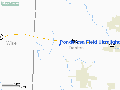
Ponderosa Field Ultralight Airport |
Location & QuickFacts
| FAA Information Effective: | 2008-09-25 |
| Airport Identifier: | XA10 |
| Airport Status: | Operational |
| Longitude/Latitude: | 097-20-19.5700W/33-13-54.9000N
-97.338769/33.231917 (Estimated) |
| Elevation: | 840 ft / 256.03 m (Estimated) |
| Land: | 5 acres |
| From nearest city: | 5 nautical miles NW of Ponder, TX |
| Location: | Denton County, TX |
| Magnetic Variation: | () |
Owner & Manager
| Ownership: | Privately owned |
| Owner: | Michael Lane |
| Address: | 12361 Wellington Road
Ponder, TX 76259 |
| Phone number: | 469-951-5910 |
| Manager: | Michael Lane |
| Address: | 12361 Wellington Road
Ponder, TX 76259 |
| Phone number: | 469-951-5910 |
Airport Operations and Facilities
| Airport Use: | Private |
| Wind indicator: | Yes |
| Segmented Circle: | No |
| Control Tower: | No |
| Sectional chart: | Dallas-ft Worth |
| Region: | ASW - Southwest |
| Boundary ARTCC: | ZFW - Fort Worth |
| Tie-in FSS: | FTW - Fort Worth |
| FSS Phone: | 817-541-3474 |
| FSS Toll Free: | 1-800-WX-BRIEF |
Runway Information
Runway 18/36
| Dimension: | 500 x 70 ft / 152.4 x 21.3 m |
| Surface: | TURF, |
| |
Runway 18 |
Runway 36 |
| Traffic Pattern: | Left | Left |
|
Radio Navigation Aids
| ID |
Type |
Name |
Ch |
Freq |
Var |
Dist |
| GLE | NDB | Gainesville | | 330.00 | 06E | 30.1 nm |
| GMZ | NDB | Grindstone Mountain | | 356.00 | 07E | 31.3 nm |
| RBD | NDB | Redbird | | 287.00 | 06E | 40.9 nm |
| XQH | NDB | Cedar Hill | | 353.00 | 08E | 42.6 nm |
| MWL | NDB | Mineral Wells | | 266.00 | 06E | 45.1 nm |
| PQF | NDB | Mesquite | | 248.00 | 06E | 48.1 nm |
| DNI | NDB | Denison | | 341.00 | 06E | 48.9 nm |
| NFW | TACAN | Nas Jrb Fort Worth | 024X | | 07E | 28.1 nm |
| TTT | VOR/DME | Maverick | 078X | 113.10 | 06E | 26.5 nm |
| CVE | VOR/DME | Cowboy | 109X | 116.20 | 06E | 30.0 nm |
| FUZ | VORTAC | Ranger | 104X | 115.70 | 06E | 22.1 nm |
| UKW | VORTAC | Bowie | 071X | 112.40 | 06E | 30.3 nm |
| MQP | VORTAC | Millsap | 124X | 117.70 | 09E | 45.0 nm |
| FTW | VOT | Fort Worth Meacham | | 108.20 | | 24.9 nm |
| DAL | VOT | Dallas Love Field | | 113.30 | | 33.7 nm |
Remarks
- PRVDD PVT USE/VFR AND ONLY USED BY ULTRALIGHT ACFT.
Images and information placed above are from
http://www.airport-data.com/airport/XA10/
We thank them for the data!
|
|


