 |
|
Location & QuickFacts
| FAA Information Effective: | 2008-09-25 |
| Airport Identifier: | 47TA |
| Airport Status: | Operational |
| Longitude/Latitude: | 096-53-07.0090W/33-15-21.4210N
-96.885280/33.255950 (Estimated) |
| Elevation: | 604 ft / 184.10 m (Estimated) |
| Land: | 0 acres |
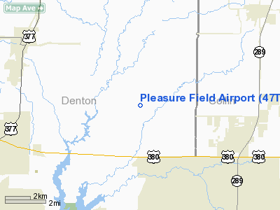
| From nearest city: | 4 nautical miles NW of Prosper, TX |
| Location: | Denton County, TX |
| Magnetic Variation: | 06E (1985) |
Owner & Manager
| Ownership: | Privately owned |
| Owner: | O. K. Kim |
| Address: | 3004 Sewanee Drive
Plano, TX 75075 |
| Phone number: | 214-596-8920 |
| Manager: | O. K. Kim |
| Address: | 3004 Sewanee Drive
Plano, TX 75075 |
| Phone number: | 214-347-2041 |
Airport Operations and Facilities
| Airport Use: | Private |
| Wind indicator: | Yes |
| Segmented Circle: | No |
| Control Tower: | No |
| Landing fee charge: | No |
| Sectional chart: | Dallas-ft Worth |
| Region: | ASW - Southwest |
| Boundary ARTCC: | ZFW - Fort Worth |
| Tie-in FSS: | FTW - Fort Worth |
| FSS on Airport: | No |
| FSS Phone: | 817-541-3474 |
| FSS Toll Free: | 1-800-WX-BRIEF |
Airport Services
| Airframe Repair: | NONE |
| Power Plant Repair: | NONE |
Runway Information
Runway N/S
| Dimension: | 2540 x 70 ft / 774.2 x 21.3 m |
| Surface: | TURF, |
| |
Runway N |
Runway S |
| Traffic Pattern: | Left | Left |
|
Radio Navigation Aids
| ID |
Type |
Name |
Ch |
Freq |
Var |
Dist |
| GLE | NDB | Gainesville | | 330.00 | 06E | 31.9 nm |
| PQF | NDB | Mesquite | | 248.00 | 06E | 32.3 nm |
| MII | NDB | Caddo Mills | | 316.00 | 06E | 34.6 nm |
| RBD | NDB | Redbird | | 287.00 | 06E | 34.8 nm |
| DNI | NDB | Denison | | 341.00 | 06E | 35.8 nm |
| JUG | NDB | Jecca | | 388.00 | 06E | 39.6 nm |
| XQH | NDB | Cedar Hill | | 353.00 | 08E | 40.2 nm |
| HJM | NDB | Rayburn | | 415.00 | 06E | 41.6 nm |
| LNC | NDB | Lancaster | | 239.00 | 06E | 41.6 nm |
| AVZ | NDB | Travis | | 260.00 | 06E | 43.8 nm |
| SYW | NDB | Cash | | 428.00 | 05E | 44.4 nm |
| DUA | NDB | Durant | | 359.00 | 05E | 47.9 nm |
| GMZ | NDB | Grindstone Mountain | | 356.00 | 07E | 49.3 nm |
| NFW | TACAN | Nas Jrb Fort Worth | 024X | | 07E | 40.3 nm |
| MJF | TACAN | Arvilla | 033X | | 05E | 43.0 nm |
| CVE | VOR/DME | Cowboy | 109X | 116.20 | 06E | 22.0 nm |
| TTT | VOR/DME | Maverick | 078X | 113.10 | 06E | 24.5 nm |
| URH | VOR/DME | Texoma | 090X | 114.30 | 05E | 48.2 nm |
| FUZ | VORTAC | Ranger | 104X | 115.70 | 06E | 26.5 nm |
| BYP | VORTAC | Bonham | 093X | 114.60 | 06E | 36.8 nm |
| UKW | VORTAC | Bowie | 071X | 112.40 | 06E | 49.9 nm |
| DAL | VOT | Dallas Love Field | | 113.30 | | 24.6 nm |
| FTW | VOT | Fort Worth Meacham | | 108.20 | | 35.5 nm |
Images and information placed above are from
http://www.airport-data.com/airport/47TA/
We thank them for the data!
| General Info
|
| Country |
United States
|
| State |
TEXAS
|
| FAA ID |
47TA
|
| Latitude |
33-15-21.421N
|
| Longitude |
096-53-07.009W
|
| Elevation |
604 feet
|
| Near City |
PROSPER
|
We don't guarantee the information is fresh and accurate. The data may
be wrong or outdated.
For more up-to-date information please refer to other sources.
|
|


