 |
|
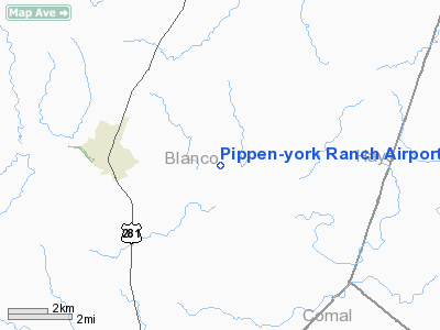
Pippen-york Ranch Airport |
Location & QuickFacts
| FAA Information Effective: | 2008-09-25 |
| Airport Identifier: | TX41 |
| Airport Status: | Operational |
| Longitude/Latitude: | 098-21-53.0660W/30-05-28.7510N
-98.364741/30.091320 (Estimated) |
| Elevation: | 1340 ft / 408.43 m (Estimated) |
| Land: | 22 acres |
| From nearest city: | 3 nautical miles E of Blanco, TX |
| Location: | Blanco County, TX |
| Magnetic Variation: | 07E (1990) |
Owner & Manager
| Ownership: | Privately owned |
| Owner: | Bill Pippen |
| Address: | Route 4, Box 70a
Blanco, TX 78606 |
| Phone number: | 915-388-9018 |
| Manager: | Bill Pippen |
| Address: | Route 4, Box 70a
Blanco, TX 78606 |
| Phone number: | 915-388-9018 |
Airport Operations and Facilities
| Airport Use: | Private |
| Segmented Circle: | No |
| Control Tower: | No |
| Sectional chart: | San Antonio |
| Region: | ASW - Southwest |
| Boundary ARTCC: | ZHU - Houston |
| Tie-in FSS: | SJT - San Angelo |
| FSS on Airport: | No |
| FSS Toll Free: | 1-800-WX-BRIEF |
Runway Information
Runway 15/33
| Dimension: | 2000 x 100 ft / 609.6 x 30.5 m |
| Surface: | TURF, |
| |
Runway 15 |
Runway 33 |
| Traffic Pattern: | Left | Left |
| Obstruction: | 40 ft pline, 100.0 ft from runway | |
|
Radio Navigation Aids
| ID |
Type |
Name |
Ch |
Freq |
Var |
Dist |
| MFS | NDB | Horseshoe Bay Resort | | 403.00 | 07E | 26.0 nm |
| ER | NDB | Shein | | 263.00 | 08E | 35.2 nm |
| BMQ | NDB | Burnet | | 341.00 | 07E | 39.6 nm |
| DHK | TACAN | Randolph | 036X | | 09E | 33.7 nm |
| KSY | TACAN | Kelly | 057X | | 07E | 43.5 nm |
| STV | VORTAC | Stonewall | 085X | 113.80 | 08E | 19.0 nm |
| SAT | VORTAC | San Antonio | 115X | 116.80 | 08E | 27.4 nm |
| RND | VORTAC | Randolph | 70X | 112.30 | 09E | 34.6 nm |
| CSI | VORTAC | Center Point | 122X | 117.50 | 08E | 45.4 nm |
| CWK | VORTAC | Centex | 075X | 112.80 | 06E | 46.7 nm |
| LLO | VORTAC | Llano | 019X | 108.20 | 08E | 47.7 nm |
| SAT | VOT | San Antonio Intl | | 110.40 | | 34.0 nm |
Images and information placed above are from
http://www.airport-data.com/airport/TX41/
We thank them for the data!
| General Info
|
| Country |
United States
|
| State |
TEXAS
|
| FAA ID |
TX41
|
| Latitude |
30-05-28.751N
|
| Longitude |
098-21-53.066W
|
| Elevation |
1340 feet
|
| Near City |
BLANCO
|
We don't guarantee the information is fresh and accurate. The data may
be wrong or outdated.
For more up-to-date information please refer to other sources.
|
|


