 |
|
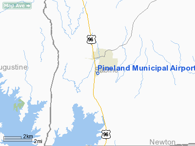
Location & QuickFacts
| FAA Information Effective: | 2008-09-25 |
| Airport Identifier: | T24 |
| Airport Status: | Operational |
| Longitude/Latitude: | 093-58-54.6800W/31-14-00.6790N
-93.981856/31.233522 (Estimated) |
| Elevation: | 260 ft / 79.25 m (Estimated) |
| Land: | 70 acres |
| From nearest city: | 1 nautical miles SW of Pineland, TX |
| Location: | Sabine County, TX |
| Magnetic Variation: | 05E (1985) |
Owner & Manager
| Ownership: | Publicly owned |
| Owner: | City Of Pineland |
| Address: | Po Box 6
Pineland, TX 75968 |
| Phone number: | 409-584-2390 |
| Manager: | Charles Corley |
| Address: | Po Box 6
Pineland, TX 75968 |
| Phone number: | 409-584-2390 |
Airport Operations and Facilities
| Airport Use: | Open to public |
| Wind indicator: | Yes |
| Segmented Circle: | Yes |
| Control Tower: | No |
| Lighting Schedule: | DUSK-DAWN
ACTVT MIRL RY 17/35 - CTAF. |
| Beacon Color: | Clear-Green (lighted land airport) |
| Landing fee charge: | No |
| Sectional chart: | Houston |
| Region: | ASW - Southwest |
| Boundary ARTCC: | ZHU - Houston |
| Tie-in FSS: | CXO - Montgomery County |
| FSS on Airport: | No |
| FSS Toll Free: | 1-800-WX-BRIEF
FOR FP FILING CALL CXO FSS 1-800-833-5602 |
| NOTAMs Facility: | CXO (NOTAM-d service avaliable) |
| Federal Agreements: | GY |
Airport Communications
| CTAF: | 122.800 |
| Unicom: | 122.800 |
Airport Services
| Fuel available: | 100LL
FUEL SELF SERVE WITH CREDIT CARD. |
| Airframe Repair: | NONE |
| Power Plant Repair: | NONE |
| Bottled Oxygen: | NONE |
| Bulk Oxygen: | NONE |
Runway Information
Runway 17/35
| Dimension: | 3700 x 75 ft / 1127.8 x 22.9 m |
| Surface: | ASPH, Good Condition |
| Weight Limit: | Single wheel: 14000 lbs. |
| Edge Lights: | Medium |
| |
Runway 17 |
Runway 35 |
| Traffic Pattern: | Left | Left |
| Markings: | Basic, Good Condition | Basic, Good Condition |
| Obstruction: | 60 ft trees, 1425.0 ft from runway, 20:1 slope to clear | 55 ft trees, 1320.0 ft from runway, 225 ft right of centerline, 20:1 slope to clear |
|
Radio Navigation Aids
| ID |
Type |
Name |
Ch |
Freq |
Var |
Dist |
| POE1 | FAN MARKER | North | | | 07E | 39.9 nm |
| POE | FAN MARKER | South | | | 07E | 44.8 nm |
| JAS | NDB | Jasper | | 344.00 | 04E | 17.0 nm |
| MMY | NDB | Many | | 272.00 | 04E | 30.4 nm |
| VED | NDB | Leesville | | 247.00 | 04E | 33.8 nm |
| CZJ | NDB | Amason | | 341.00 | 04E | 37.1 nm |
| OC | NDB | Nados | | 253.00 | 05E | 40.8 nm |
| GUV | NDB | Gator | | 359.00 | 05E | 42.8 nm |
| DR | NDB | Idder | | 385.00 | 04E | 44.1 nm |
| GXD | NDB | Nacogdoches | | 391.00 | 05E | 44.7 nm |
| LFK | VORTAC | Lufkin | 058X | 112.10 | 05E | 38.0 nm |
| FXU | VORTAC | Polk | 021X | 108.40 | 05E | 40.0 nm |
Images and information placed above are from
http://www.airport-data.com/airport/T24/
We thank them for the data!
| General Info
|
| Country |
United States
|
| State |
TEXAS
|
| FAA ID |
T24
|
| Latitude |
31-14-00.679N
|
| Longitude |
093-58-54.680W
|
| Elevation |
260 feet
|
| Near City |
PINELAND
|
We don't guarantee the information is fresh and accurate. The data may
be wrong or outdated.
For more up-to-date information please refer to other sources.
|
|


