 |
|
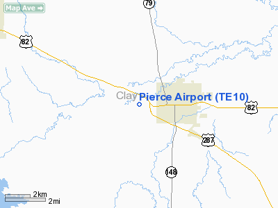
Location & QuickFacts
| FAA Information Effective: | 2008-09-25 |
| Airport Identifier: | TE10 |
| Airport Status: | Operational |
| Longitude/Latitude: | 098-13-41.1630W/33-48-55.3600N
-98.228101/33.815378 (Estimated) |
| Elevation: | 885 ft / 269.75 m (Estimated) |
| Land: | 0 acres |
| From nearest city: | 1 nautical miles W of Henrietta, TX |
| Location: | Clay County, TX |
| Magnetic Variation: | 07E (1985) |
Owner & Manager
| Ownership: | Privately owned |
| Owner: | Jeff Pierce |
| Address: | Rt 1 Box 241b
Henrietta, TX 76365 |
| Phone number: | 817-538-5908 |
| Manager: | Jeff Pierce |
| Address: | Rt 1 Box 241b
Henrieta, TX 76365 |
| Phone number: | 817-538-5643 |
Airport Operations and Facilities
| Airport Use: | Private |
| Wind indicator: | Yes |
| Segmented Circle: | No |
| Control Tower: | No |
| Sectional chart: | Dallas-ft Worth |
| Region: | ASW - Southwest |
| Boundary ARTCC: | ZFW - Fort Worth |
| Tie-in FSS: | FTW - Fort Worth |
| FSS Phone: | 817-541-3474 |
| FSS Toll Free: | 1-800-WX-BRIEF |
Airport Communications
Runway Information
Runway 04/22
| Dimension: | 2200 x 60 ft / 670.6 x 18.3 m |
| Surface: | TURF, |
| |
Runway 04 |
Runway 22 |
| Traffic Pattern: | Left | Left |
| Obstruction: | | 20 ft plines, 600.0 ft from runway |
|
Radio Navigation Aids
| ID |
Type |
Name |
Ch |
Freq |
Var |
Dist |
| SKB | NDB | Scotland | | 344.00 | 08E | 13.0 nm |
| GMZ | NDB | Grindstone Mountain | | 356.00 | 07E | 26.0 nm |
| ONY | NDB | Olney | | 272.00 | 07E | 40.6 nm |
| GHX | NDB | Graham | | 371.00 | 07E | 41.3 nm |
| PFL | NDB | Post | | 308.00 | 08E | 48.5 nm |
| SHP | TACAN | Sheppard | 045X | | 10E | 16.4 nm |
| DUC | VOR/DME | Duncan | 047X | 111.00 | 09E | 37.6 nm |
| LAW | VOR/DME | Lawton | 031X | 109.40 | 09E | 41.9 nm |
| SPS | VORTAC | Wichita Falls | 074X | 112.70 | 10E | 21.0 nm |
| UKW | VORTAC | Bowie | 071X | 112.40 | 06E | 26.4 nm |
Images and information placed above are from
http://www.airport-data.com/airport/TE10/
We thank them for the data!
| General Info
|
| Country |
United States
|
| State |
TEXAS
|
| FAA ID |
TE10
|
| Latitude |
33-48-55.360N
|
| Longitude |
098-13-41.163W
|
| Elevation |
885 feet
|
| Near City |
HENRIETTA
|
We don't guarantee the information is fresh and accurate. The data may
be wrong or outdated.
For more up-to-date information please refer to other sources.
|
|


