 |
|
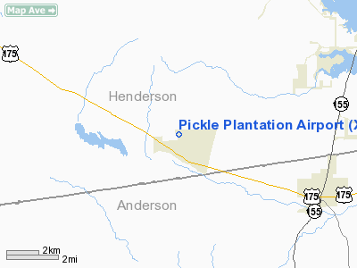
Pickle Plantation Airport |
Location & QuickFacts
| FAA Information Effective: | 2008-09-25 |
| Airport Identifier: | XS91 |
| Airport Status: | Operational |
| Longitude/Latitude: | 095-35-57.6000W/32-05-11.4000N
-95.599333/32.086500 (Estimated) |
| Elevation: | 580 ft / 176.78 m (Estimated) |
| Land: | 188 acres |
| From nearest city: | 1 nautical miles NW of Poynor, TX |
| Location: | Henderson County, TX |
| Magnetic Variation: | 05E (2000) |
Owner & Manager
| Ownership: | Privately owned |
| Owner: | J. R. Bob Pickle |
| Address: | Po Box 206
Poynor, TX 75782 |
| Phone number: | 903-876-3135 |
| Manager: | J. R. Bob Pickle |
| Address: | Po Box 206
Poynor, TX 75782 |
| Phone number: | 903-876-3135 |
Airport Operations and Facilities
| Airport Use: | Private |
| Wind indicator: | Yes |
| Segmented Circle: | No |
| Control Tower: | No |
| Sectional chart: | Dallas-ft Worth |
| Region: | ASW - Southwest |
| Boundary ARTCC: | ZFW - Fort Worth |
| Tie-in FSS: | FTW - Fort Worth |
| FSS Phone: | 817-541-3474 |
| FSS Toll Free: | 1-800-WX-BRIEF |
Runway Information
Runway 17/35
| Dimension: | 3200 x 40 ft / 975.4 x 12.2 m |
| Surface: | ASPH-TURF,
200 FT TURF EACH END OF RY & 10 FT TURF EACH SIDE OF RY. |
| |
Runway 17 |
Runway 35 |
| Traffic Pattern: | Left | Left |
|
Radio Navigation Aids
| ID |
Type |
Name |
Ch |
Freq |
Var |
Dist |
| AHX | NDB | Athens | | 269.00 | 06E | 12.5 nm |
| CSZ | NDB | Crossroads | | 215.00 | 08E | 18.3 nm |
| LIQ | NDB | Lochridge Ranch | | 335.00 | 09E | 18.6 nm |
| PSN | NDB | Palestine | | 375.00 | 04E | 19.1 nm |
| TY | NDB | Tyler | | 320.00 | 06E | 20.9 nm |
| JSO | NDB | Cherokee County | | 263.00 | 05E | 23.5 nm |
| PYF | NDB | Pyramid | | 418.00 | 06E | 33.3 nm |
| HNO | NDB | Henderson | | 371.00 | 06E | 38.1 nm |
| ABG | NDB | Ambassador | | 404.00 | 07E | 38.9 nm |
| CRS | NDB | Corsicana | | 396.00 | 06E | 40.7 nm |
| CGQ | NDB | Powell | | 344.00 | 06E | 42.2 nm |
| FZT | VOR/DME | Frankston | 051X | 111.40 | 06E | 3.6 nm |
| TYR | VOR/DME | Tyler | 089X | 114.20 | 06E | 19.0 nm |
| UIM | VOR/DME | Quitman | 087X | 114.00 | 08E | 49.2 nm |
| CQY | VORTAC | Cedar Creek | 095X | 114.80 | 06E | 32.1 nm |
| GGG | VORTAC | Gregg County | 070X | 112.30 | 07E | 47.4 nm |
Images and information placed above are from
http://www.airport-data.com/airport/XS91/
We thank them for the data!
| General Info
|
| Country |
United States
|
| State |
TEXAS
|
| FAA ID |
XS91
|
| Latitude |
32-05-11.400N
|
| Longitude |
095-35-57.600W
|
| Elevation |
580 feet
|
| Near City |
POYNOR
|
We don't guarantee the information is fresh and accurate. The data may
be wrong or outdated.
For more up-to-date information please refer to other sources.
|
|


