 |
|
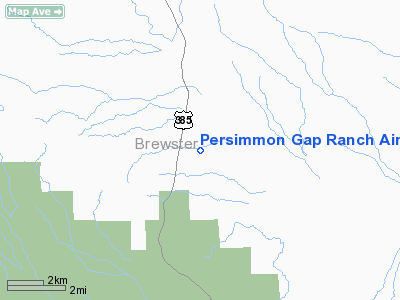
Persimmon Gap Ranch Airport |
Location & QuickFacts
| FAA Information Effective: | 2008-09-25 |
| Airport Identifier: | TA64 |
| Airport Status: | Operational |
| Longitude/Latitude: | 103-09-00.0000W/29-42-03.3000N
-103.150000/29.700917 (Estimated) |
| Elevation: | 2680 ft / 816.86 m (Estimated) |
| Land: | 0 acres |
| From nearest city: | 37 nautical miles S of Marathon, TX |
| Location: | Brewster County, TX |
| Magnetic Variation: | () |
Owner & Manager
| Ownership: | Privately owned |
| Owner: | J. B. Love Jr. |
| Address: | Hc 65 Box 440
Alpine, TX 79832 |
| Phone number: | 432-376-2214 |
| Manager: | J. B. Love Jr. |
| Address: | Hc 65 Box 440
Alpine, TX 79832 |
| Phone number: | 432-376-2214 |
Airport Operations and Facilities
| Airport Use: | Private |
| Control Tower: | No |
| Sectional chart: | El Paso |
| Region: | ASW - Southwest |
| Boundary ARTCC: | ZAB - Albuquerque |
| Tie-in FSS: | SJT - San Angelo |
| FSS Toll Free: | 1-800-WX-BRIEF |
Runway Information
Runway 09/27
| Dimension: | 4200 x 100 ft / 1280.2 x 30.5 m |
| Surface: | DIRT, |
| |
Runway 09 |
Runway 27 |
| Traffic Pattern: | Left | Left |
| Obstruction: | | 35 ft pline, 600.0 ft from runway |
|
Radio Navigation Aids
| ID |
Type |
Name |
Ch |
Freq |
Var |
Dist |
| IMP | NDB | Marathon | | 388.00 | 10E | 34.2 nm |
Images and information placed above are from
http://www.airport-data.com/airport/TA64/
We thank them for the data!
| General Info
|
| Country |
United States
|
| State |
TEXAS
|
| FAA ID |
TA64
|
| Latitude |
29-48-58.793N
|
| Longitude |
099-23-08.162W
|
| Elevation |
2100 feet
|
| Near City |
MEDINA
|
We don't guarantee the information is fresh and accurate. The data may
be wrong or outdated.
For more up-to-date information please refer to other sources.
|
|


