 |
|
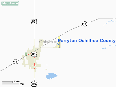
Perryton Ochiltree County Airport |
Location & QuickFacts
| FAA Information Effective: | 2008-09-25 |
| Airport Identifier: | PYX |
| Airport Status: | Operational |
| Longitude/Latitude: | 100-45-05.6770W/36-24-46.5030N
-100.751577/36.412917 (Estimated) |
| Elevation: | 2918 ft / 889.41 m (Surveyed) |
| Land: | 270 acres |
| From nearest city: | 3 nautical miles E of Perryton, TX |
| Location: | Ochiltree County, TX |
| Magnetic Variation: | 09E (1985) |
Owner & Manager
| Ownership: | Publicly owned |
| Owner: | Perryton & Ochiltree County |
| Address: | 511 S Main
Perryton, TX 79070 |
| Phone number: | 806-435-8075 |
| Manager: | Kerry Kelly |
| Address: | Box 887
Perryton, TX 79070 |
| Phone number: | 806-435-4226 |
Airport Operations and Facilities
| Airport Use: | Open to public |
| Wind indicator: | Yes |
| Segmented Circle: | Yes |
| Control Tower: | No |
| Lighting Schedule: | DUSK-DAWN
MIRL RY 17/35 PRESET LOW INTST; TO INCR INTST ACTVT - CTAF. |
| Beacon Color: | Clear-Green (lighted land airport) |
| Landing fee charge: | No |
| Sectional chart: | Wichita |
| Region: | ASW - Southwest |
| Traffic Pattern Alt: | 1000 ft |
| Boundary ARTCC: | ZKC - Kansas City |
| Tie-in FSS: | FTW - Fort Worth |
| FSS on Airport: | No |
| FSS Phone: | 817-541-3474 |
| FSS Toll Free: | 1-800-WX-BRIEF |
| NOTAMs Facility: | PYX (NOTAM-d service avaliable) |
| Federal Agreements: | NGY |
Airport Communications
| CTAF: | 122.800 |
| Unicom: | 122.800 |
Airport Services
| Fuel available: | 100LLA1+
FOR FUEL AFT HRS CALL 806-435-4226 OR 806-435-6774. |
| Airframe Repair: | MAJOR |
| Power Plant Repair: | MAJOR |
| Bottled Oxygen: | NONE |
| Bulk Oxygen: | NONE |
Runway Information
Runway 04/22
| Dimension: | 3280 x 144 ft / 999.7 x 43.9 m
SOUTH 1000 FT CLSD INDEFLY. |
| Surface: | TURF, Good Condition |
| |
Runway 04 |
Runway 22 |
| Longitude: | 100-45-32.9460W | 100-45-01.7300W |
| Latitude: | 36-24-23.8230N | 36-24-44.2010N |
| Elevation: | 2915.00 ft | 2915.00 ft |
| Alignment: | 51 | 127 |
| Traffic Pattern: | Left | Left |
| Obstruction: | 15 ft road, 60.0 ft from runway, 75 ft right of centerline, 4:1 slope to clear | 30 ft pline, 1200.0 ft from runway, 120 ft left of centerline, 40:1 slope to clear |
|
Runway 17/35
| Dimension: | 5700 x 75 ft / 1737.4 x 22.9 m
SOUTH 1000 FT CLSD INDEFLY. |
| Surface: | ASPH, |
| Weight Limit: | Single wheel: 12500 lbs. |
| Edge Lights: | Medium |
| |
Runway 17 |
Runway 35 |
| Longitude: | 100-44-59.0460W | 100-44-58.8893W |
| Latitude: | 36-25-21.8730N | 36-24-25.5098N |
| Elevation: | 2914.00 ft | 2915.00 ft |
| Alignment: | 127 | 127 |
| Traffic Pattern: | Left | Left |
| Markings: | Non-precision instrument, Good Condition | Non-precision instrument, Good Condition |
| Crossing Height: | 40.00 ft | 23.00 ft |
| VASI: | 4-light PAPI on left side | 2-box on left side |
| Visual Glide Angle: | 3.00° | 3.50° |
| Obstruction: | 25 ft pole, 800.0 ft from runway, 200 ft right of centerline, 24:1 slope to clear | 15 ft road, 500.0 ft from runway, 20:1 slope to clear |
|
Radio Navigation Aids
| ID |
Type |
Name |
Ch |
Freq |
Var |
Dist |
| PYX | NDB | Perryton | | 266.00 | 09E | 0.2 nm |
| HHF | NDB | Hemphill County | | 400.00 | 08E | 35.6 nm |
| GUY | NDB | Guymon | | 275.00 | 09E | 40.4 nm |
| PPA | NDB | Pampa | | 368.00 | 09E | 49.5 nm |
| LBL | VORTAC | Liberal | 070X | 112.30 | 11E | 39.4 nm |
| GAG | VORTAC | Gage | 103X | 115.60 | 10E | 42.4 nm |
| BGD | VORTAC | Borger | 023X | 108.60 | 11E | 47.6 nm |
Images and information placed above are from
http://www.airport-data.com/airport/PYX/
We thank them for the data!
| General Info
|
| Country |
United States
|
| State |
TEXAS
|
| FAA ID |
PYX
|
| Latitude |
36-24-50.200N
|
| Longitude |
100-44-59.000W
|
| Elevation |
2918 feet
|
| Near City |
PERRYTON
|
We don't guarantee the information is fresh and accurate. The data may
be wrong or outdated.
For more up-to-date information please refer to other sources.
|
|


