 |
|
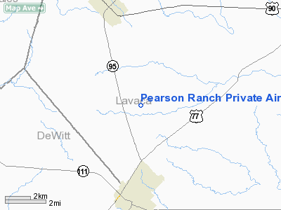
Pearson Ranch Private Airport |
Location & QuickFacts
| FAA Information Effective: | 2008-09-25 |
| Airport Identifier: | 5TA3 |
| Airport Status: | Operational |
| Longitude/Latitude: | 097-08-40.9500W/29-21-30.8790N
-97.144708/29.358577 (Estimated) |
| Elevation: | 350 ft / 106.68 m (Estimated) |
| Land: | 0 acres |
| From nearest city: | 4 nautical miles N of Yoakum, TX |
| Location: | Lavaca County, TX |
| Magnetic Variation: | 07E (1985) |
Owner & Manager
| Ownership: | Privately owned |
| Owner: | J.w. Pearson |
| Address: | Rt 2, Box 273
Yoakum, TX 77995 |
| Phone number: | 512-594-3789 |
| Manager: | J.w. Pearson |
| Address: | Rt 2, Box 273
Yoakum, TX 77995 |
| Phone number: | 512-594-3789 |
Airport Operations and Facilities
| Airport Use: | Private |
| Wind indicator: | Yes |
| Segmented Circle: | No |
| Control Tower: | No |
| Landing fee charge: | No |
| Sectional chart: | San Antonio |
| Region: | ASW - Southwest |
| Boundary ARTCC: | ZHU - Houston |
| Tie-in FSS: | CXO - Montgomery County |
| FSS on Airport: | No |
| FSS Toll Free: | 1-800-WX-BRIEF
FOR FP FILING CALL CXO FSS 1-800-833-5602. |
Runway Information
Runway 16/34
| Dimension: | 2200 x 75 ft / 670.6 x 22.9 m |
| Surface: | TURF, |
| |
Runway 16 |
Runway 34 |
| Traffic Pattern: | Left | Left |
|
Radio Navigation Aids
| ID |
Type |
Name |
Ch |
Freq |
Var |
Dist |
| OKT | NDB | Yoakum | | 350.00 | 06E | 2.8 nm |
| PKV | NDB | Port Lavaca | | 515.00 | 05E | 49.0 nm |
| GYB | NDB | Lee County | | 385.00 | 07E | 49.5 nm |
| VCT | VOR/DME | Victoria | 027X | 109.00 | 06E | 28.9 nm |
| ELA | VOR/DME | Eagle Lake | 111X | 116.40 | 08E | 47.0 nm |
| IDU | VORTAC | Industry | 039X | 110.20 | 08E | 47.1 nm |
Remarks
- PRVDD LNDG THR ON SOUTH END IS DSPLCD SUF DSTC THAT AN APCH SLOPE OF 20:1 WILL PRVD 15' VERTICAL CLNC OVER ROAD.
Images and information placed above are from
http://www.airport-data.com/airport/5TA3/
We thank them for the data!
| General Info
|
| Country |
United States
|
| State |
TEXAS
|
| FAA ID |
5TA3
|
| Latitude |
29-21-30.879N
|
| Longitude |
097-08-40.950W
|
| Elevation |
350 feet
|
| Near City |
YOAKUM
|
We don't guarantee the information is fresh and accurate. The data may
be wrong or outdated.
For more up-to-date information please refer to other sources.
|
|


