 |
|
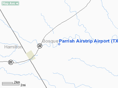
Location & QuickFacts
| FAA Information Effective: | 2008-09-25 |
| Airport Identifier: | TX52 |
| Airport Status: | Operational |
| Longitude/Latitude: | 097-46-26.0910W/31-47-40.5570N
-97.773914/31.794599 (Estimated) |
| Elevation: | 917 ft / 279.50 m (Estimated) |
| Land: | 0 acres |
| From nearest city: | 3 nautical miles E of Cranfills Gap, TX |
| Location: | Bosque County, TX |
| Magnetic Variation: | 07E (1985) |
Owner & Manager
| Ownership: | Privately owned |
| Owner: | Larry Cox |
| Address: | 2662 County Road 4145
Cranfills Gap, TX 76637 |
| Phone number: | 254-597-2706 |
| Manager: | Jeffrey Rose |
| Address: | 275 Private Road 4148
Cranfills Gap, TX 76637 |
| Phone number: | 254-597-2363 |
Airport Operations and Facilities
| Airport Use: | Private |
| Wind indicator: | Yes |
| Segmented Circle: | No |
| Control Tower: | No |
| Landing fee charge: | No |
| Sectional chart: | San Antonio |
| Region: | ASW - Southwest |
| Boundary ARTCC: | ZFW - Fort Worth |
| Tie-in FSS: | FTW - Fort Worth |
| FSS on Airport: | No |
| FSS Phone: | 817-541-3474 |
| FSS Toll Free: | 1-800-WX-BRIEF |
Airport Services
| Airframe Repair: | NONE |
| Power Plant Repair: | NONE |
Runway Information
Runway 14/32
| Dimension: | 2000 x 90 ft / 609.6 x 27.4 m |
| Surface: | TURF, |
| |
Runway 14 |
Runway 32 |
| Traffic Pattern: | Left | Left |
|
Radio Navigation Aids
| ID |
Type |
Name |
Ch |
Freq |
Var |
Dist |
| MNZ | NDB | Hamilton | | 251.00 | 07E | 21.8 nm |
| GR | NDB | Starn | | 323.00 | 07E | 38.1 nm |
| ROB | NDB | Robinson | | 400.00 | 07E | 40.1 nm |
| HLR | NDB | Hood | | 347.00 | 07E | 40.1 nm |
| IL | NDB | Iresh | | 278.00 | 07E | 46.4 nm |
| TPL | VOR/DME | Temple | 041X | 110.40 | 09E | 39.5 nm |
| GRK | VOR/DME | Gray | 055X | 111.80 | 07E | 45.8 nm |
| JEN | VORTAC | Glen Rose | 097X | 115.00 | 06E | 22.6 nm |
| ACT | VORTAC | Waco | 100X | 115.30 | 09E | 27.0 nm |
| LZZ | VORTAC | Lampasas | 072X | 112.50 | 08E | 41.2 nm |
Remarks
Images and information placed above are from
http://www.airport-data.com/airport/TX52/
We thank them for the data!
| General Info
|
| Country |
United States
|
| State |
TEXAS
|
| FAA ID |
TX52
|
| Latitude |
31-47-40.557N
|
| Longitude |
097-46-26.091W
|
| Elevation |
917 feet
|
| Near City |
CRANFILLS GAP
|
We don't guarantee the information is fresh and accurate. The data may
be wrong or outdated.
For more up-to-date information please refer to other sources.
|
|


