 |
|
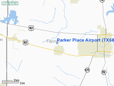
Location & QuickFacts
| FAA Information Effective: | 2008-09-25 |
| Airport Identifier: | TX68 |
| Airport Status: | Operational |
| Longitude/Latitude: | 096-16-35.9330W/33-35-30.3800N
-96.276648/33.591772 (Estimated) |
| Elevation: | 620 ft / 188.98 m (Estimated) |
| Land: | 0 acres |
| From nearest city: | 0 nautical miles of Ector, TX |
| Location: | Fannin County, TX |
| Magnetic Variation: | 06E (1985) |
Owner & Manager
| Ownership: | Privately owned |
| Owner: | Thomas C Keener |
| Address: | Box 96
Ector, TX 75439 |
| Address: |
|
Airport Operations and Facilities
| Airport Use: | Private |
| Wind indicator: | Yes |
| Segmented Circle: | No |
| Control Tower: | No |
| Landing fee charge: | No |
| Sectional chart: | Dallas-ft Worth |
| Region: | ASW - Southwest |
| Boundary ARTCC: | ZFW - Fort Worth |
| Tie-in FSS: | FTW - Fort Worth |
| FSS on Airport: | No |
| FSS Phone: | 817-541-3474 |
| FSS Toll Free: | 1-800-WX-BRIEF |
Runway Information
Runway 16/34
| Dimension: | 2600 x 50 ft / 792.5 x 15.2 m |
| Surface: | TURF, |
| |
Runway 16 |
Runway 34 |
| Traffic Pattern: | Left | Left |
|
Radio Navigation Aids
| ID |
Type |
Name |
Ch |
Freq |
Var |
Dist |
| HJM | NDB | Rayburn | | 415.00 | 06E | 5.2 nm |
| DUA | NDB | Durant | | 359.00 | 05E | 22.0 nm |
| DNI | NDB | Denison | | 341.00 | 06E | 24.1 nm |
| MII | NDB | Caddo Mills | | 316.00 | 06E | 33.2 nm |
| SYW | NDB | Cash | | 428.00 | 05E | 38.1 nm |
| HHW | NDB | Hugo | | 323.00 | 05E | 45.6 nm |
| GLE | NDB | Gainesville | | 330.00 | 06E | 46.8 nm |
| AEE | NDB | Antlers | | 391.00 | 05E | 47.7 nm |
| PQF | NDB | Mesquite | | 248.00 | 06E | 48.7 nm |
| MJF | TACAN | Arvilla | 033X | | 05E | 33.4 nm |
| URH | VOR/DME | Texoma | 090X | 114.30 | 05E | 22.0 nm |
| PRX | VOR/DME | Paris | 083X | 113.60 | 07E | 41.6 nm |
| SLR | VOR/DME | Sulphur Springs | 027X | 109.00 | 08E | 43.8 nm |
| BYP | VORTAC | Bonham | 093X | 114.60 | 06E | 3.9 nm |
Remarks
- MARKED WATER TOWER IN ECTOR.
Images and information placed above are from
http://www.airport-data.com/airport/TX68/
We thank them for the data!
| General Info
|
| Country |
United States
|
| State |
TEXAS
|
| FAA ID |
TX68
|
| Latitude |
33-35-30.380N
|
| Longitude |
096-16-35.933W
|
| Elevation |
620 feet
|
| Near City |
ECTOR
|
We don't guarantee the information is fresh and accurate. The data may
be wrong or outdated.
For more up-to-date information please refer to other sources.
|
|


