 |
|
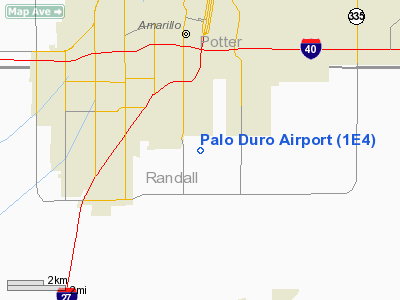
Location & QuickFacts
| FAA Information Effective: | 2008-09-25 |
| Airport Identifier: | 1E4 |
| Airport Status: | Operational |
| Longitude/Latitude: | 101-50-16.6730W/35-08-31.1920N
-101.837965/35.141998 (Estimated) |
| Elevation: | 3639 ft / 1109.17 m (Estimated) |
| Land: | 40 acres |
| From nearest city: | 3 nautical miles S of Amarillo, TX |
| Location: | Randall County, TX |
| Magnetic Variation: | 09E (1985) |
Owner & Manager
| Ownership: | Privately owned |
| Owner: | Donald Conley |
| Address: | Po Box 1605
Amarillo, TX 79105 |
| Phone number: | 806-376-5853 |
| Manager: | Donald Conley |
| Address: | Po Box 1605
Amarillo, TX 79105 |
| Phone number: | 806-376-5853 |
Airport Operations and Facilities
| Airport Use: | Open to public |
| Wind indicator: | Yes |
| Segmented Circle: | No |
| Control Tower: | No |
| Landing fee charge: | No |
| Sectional chart: | Dallas-ft Worth |
| Region: | ASW - Southwest |
| Boundary ARTCC: | ZAB - Albuquerque |
| Tie-in FSS: | FTW - Fort Worth |
| FSS on Airport: | No |
| FSS Phone: | 817-541-3474 |
| FSS Toll Free: | 1-800-WX-BRIEF |
| NOTAMs Facility: | FTW (NOTAM-d service avaliable) |
Airport Communications
Runway Information
Runway 17/35
| Dimension: | 3700 x 50 ft / 1127.8 x 15.2 m |
| Surface: | TURFRVL, Good Condition
SOFT WHEN WET ON SOUTH END; LOOSE GRAVEL ON RUNWAY. |
| |
Runway 17 |
Runway 35 |
| Traffic Pattern: | Left | Left |
| Obstruction: | 63 ft pline | 7 ft fence, 0.0 ft from runway |
|
Radio Navigation Aids
| ID |
Type |
Name |
Ch |
Freq |
Var |
Dist |
| AM | NDB | Pande | | 251.00 | 09E | 1.6 nm |
| HRX | NDB | Hereford | | 341.00 | 09E | 29.4 nm |
| DUX | NDB | Durrett | | 414.00 | 09E | 44.2 nm |
| PNH | VORTAC | Panhandle | 113X | 116.60 | 08E | 8.8 nm |
| BGD | VORTAC | Borger | 023X | 108.60 | 11E | 45.8 nm |
Remarks
- ARPT HAZARDOUS FOR TSNTS; RY NOT MKD OR DEFINED; 63 FT TRANSMISSION LINE ACROSS THR OF RY 17.
Images and information placed above are from
http://www.airport-data.com/airport/1E4/
We thank them for the data!
| General Info
|
| Country |
United States
|
| State |
TEXAS
|
| FAA ID |
1E4
|
| Latitude |
35-08-31.192N
|
| Longitude |
101-50-16.673W
|
| Elevation |
3639 feet
|
| Near City |
AMARILLO
|
We don't guarantee the information is fresh and accurate. The data may
be wrong or outdated.
For more up-to-date information please refer to other sources.
|
|


