 |
|
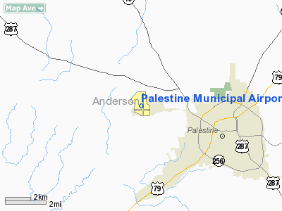
Location & QuickFacts
| FAA Information Effective: | 2008-09-25 |
| Airport Identifier: | PSN |
| Airport Status: | Operational |
| Longitude/Latitude: | 095-42-22.7000W/31-46-46.9000N
-95.706306/31.779694 (Estimated) |
| Elevation: | 423 ft / 128.93 m (Surveyed) |
| Land: | 524 acres |
| From nearest city: | 4 nautical miles NW of Palestine, TX |
| Location: | Anderson County, TX |
| Magnetic Variation: | 04E (2005) |
Owner & Manager
| Ownership: | Publicly owned |
| Owner: | City Of Palestine
ATTN: RON SULLIVAN. |
| Address: | 504 N Queen
Palestine, TX 75801 |
| Phone number: | 903-731-8423 |
| Manager: | Toni Graser |
| Address: | 1278 Cr 421
Palestine, TX 75803 |
| Phone number: | 903-723-0111 |
Airport Operations and Facilities
| Airport Use: | Open to public |
| Wind indicator: | Yes |
| Segmented Circle: | Yes |
| Control Tower: | No |
| Lighting Schedule: | DUSK-DAWN |
| Beacon Color: | Clear-Green (lighted land airport) |
| Landing fee charge: | No |
| Sectional chart: | Houston |
| Region: | ASW - Southwest |
| Boundary ARTCC: | ZFW - Fort Worth |
| Tie-in FSS: | FTW - Fort Worth |
| FSS on Airport: | No |
| FSS Phone: | 817-541-3474 |
| FSS Toll Free: | 1-800-WX-BRIEF |
| NOTAMs Facility: | PSN (NOTAM-d service avaliable) |
| Federal Agreements: | NGY3 |
Airport Communications
| CTAF: | 122.700 |
| Unicom: | 122.700 |
Airport Services
| Fuel available: | 100LLA |
| Airframe Repair: | MINOR |
| Power Plant Repair: | MINOR |
| Bottled Oxygen: | NONE |
| Bulk Oxygen: | NONE |
Runway Information
Runway 09/27
| Dimension: | 4003 x 75 ft / 1220.1 x 22.9 m |
| Surface: | ASPH, Fair Condition |
| Weight Limit: | Single wheel: 45000 lbs.
Dual wheel: 70000 lbs.
Dual tandem wheel: 135000 lbs. |
| Edge Lights: | Medium |
| |
Runway 09 |
Runway 27 |
| Longitude: | 095-42-45.7500W | 095-41-59.3790W |
| Latitude: | 31-46-37.4650N | 31-46-37.0820N |
| Elevation: | 423.00 ft | 388.00 ft |
| Alignment: | 91 | 127 |
| Traffic Pattern: | Left | Left |
| Markings: | Basic, Fair Condition | Basic, Fair Condition |
| Obstruction: | 2 ft trees, 200.0 ft from runway
+2 FT BRUSH ACROSS APCH 170 FT FM THLD. | 25 ft trees, 285.0 ft from runway, 100 ft left of centerline, 3:1 slope to clear |
|
Runway 18/36
| Dimension: | 5005 x 100 ft / 1525.5 x 30.5 m |
| Surface: | ASPH, Good Condition |
| Weight Limit: | Single wheel: 45000 lbs.
Dual wheel: 70000 lbs.
Dual tandem wheel: 135000 lbs. |
| Edge Lights: | Medium |
| |
Runway 18 |
Runway 36 |
| Longitude: | 095-42-22.5490W | 095-42-23.0770W |
| Latitude: | 31-47-19.3650N | 31-46-29.8340N |
| Elevation: | 413.00 ft | 410.00 ft |
| Alignment: | 127 | 1 |
| Traffic Pattern: | Left | Left |
| Markings: | Non-precision instrument, Good Condition | Non-precision instrument, Fair Condition |
| Runway End Identifier: | | Yes |
| Obstruction: | 24 ft tree, 461.0 ft from runway, 250 ft right of centerline, 10:1 slope to clear | 23 ft trees, 267.0 ft from runway, 252 ft left of centerline, 2:1 slope to clear
+6-20 FT BRUSH AND TREES 30-100 FT FM END OF RY 230 FT LEFT. |
|
Radio Navigation Aids
| ID |
Type |
Name |
Ch |
Freq |
Var |
Dist |
| PSN | NDB | Palestine | | 375.00 | 04E | 0.3 nm |
| LIQ | NDB | Lochridge Ranch | | 335.00 | 09E | 18.7 nm |
| CSZ | NDB | Crossroads | | 215.00 | 08E | 21.3 nm |
| AHX | NDB | Athens | | 269.00 | 06E | 23.7 nm |
| PYF | NDB | Pyramid | | 418.00 | 06E | 25.6 nm |
| JSO | NDB | Cherokee County | | 263.00 | 05E | 25.6 nm |
| CRS | NDB | Corsicana | | 396.00 | 06E | 38.2 nm |
| TY | NDB | Tyler | | 320.00 | 06E | 40.1 nm |
| CGQ | NDB | Powell | | 344.00 | 06E | 40.6 nm |
| LXY | NDB | Mexia | | 329.00 | 07E | 42.1 nm |
| HNO | NDB | Henderson | | 371.00 | 06E | 49.6 nm |
| FZT | VOR/DME | Frankston | 051X | 111.40 | 06E | 19.9 nm |
| TYR | VOR/DME | Tyler | 089X | 114.20 | 06E | 37.9 nm |
| GNL | VOR/DME | Groesbeck | 025X | 108.80 | 05E | 44.7 nm |
| CQY | VORTAC | Cedar Creek | 095X | 114.80 | 06E | 35.7 nm |
| LOA | VORTAC | Leona | 045X | 110.80 | 08E | 41.6 nm |
Remarks
Images and information placed above are from
http://www.airport-data.com/airport/PSN/
We thank them for the data!
| General Info
|
| Country |
United States
|
| State |
TEXAS
|
| FAA ID |
PSN
|
| Latitude |
31-46-46.900N
|
| Longitude |
095-42-22.700W
|
| Elevation |
423 feet
|
| Near City |
PALESTINE
|
We don't guarantee the information is fresh and accurate. The data may
be wrong or outdated.
For more up-to-date information please refer to other sources.
|
|


