 |
|
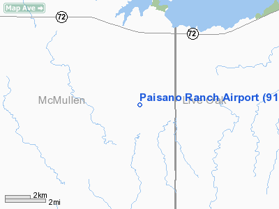
Location & QuickFacts
| FAA Information Effective: | 2008-09-25 |
| Airport Identifier: | 91TX |
| Airport Status: | Operational |
| Longitude/Latitude: | 098-21-46.0410W/28-23-48.9860N
-98.362789/28.396941 (Estimated) |
| Elevation: | 235 ft / 71.63 m (Surveyed) |
| Land: | 0 acres |
| From nearest city: | 5 nautical miles S of Calliham, TX |
| Location: | Mc Mullen County, TX |
| Magnetic Variation: | 07E (1985) |
Owner & Manager
| Ownership: | Privately owned |
| Owner: | B. Gentry Ventures Llc |
| Address: | 12220 Katy Freeway
Houston, TX 77079 |
| Phone number: | 281-589-3131 |
| Manager: | Mark Phillips |
| Address: | 2732 S. Padre Island Dr #333
Corpus Christi, TX 78415 |
| Phone number: | 361-727-2295 |
Airport Operations and Facilities
| Airport Use: | Private |
| Wind indicator: | Yes |
| Segmented Circle: | No |
| Control Tower: | No |
| Lighting Schedule: | PHONE REQ
FOR LIRL RY 15/33 CALL 361-737-2295. |
| Landing fee charge: | No |
| Sectional chart: | San Antonio |
| Region: | ASW - Southwest |
| Boundary ARTCC: | ZHU - Houston |
| Tie-in FSS: | SJT - San Angelo |
| FSS on Airport: | No |
| FSS Toll Free: | 1-800-WX-BRIEF |
Airport Services
| Airframe Repair: | NONE |
| Power Plant Repair: | NONE |
Runway Information
Runway 15/33
| Dimension: | 4750 x 50 ft / 1447.8 x 15.2 m |
| Surface: | ASPH, |
| Edge Lights: | Low |
| |
Runway 15 |
Runway 33 |
| Traffic Pattern: | Left | Left |
| Obstruction: | | 40 ft trees, 250.0 ft from runway |
|
Radio Navigation Aids
| ID |
Type |
Name |
Ch |
Freq |
Var |
Dist |
| BEA | NDB | Beeville | | 284.00 | 07E | 30.1 nm |
| PEZ | NDB | Pleasanton | | 275.00 | 07E | 34.5 nm |
| TKB | NDB | Kleberg County | | 347.00 | 06E | 49.7 nm |
| NOG | TACAN | Orange Grove | 063X | | 09E | 34.6 nm |
| ALI | VOR | Alice | | 114.50 | 06E | 43.5 nm |
| THX | VORTAC | Three Rivers | 051X | 111.40 | 08E | 13.0 nm |
| COT | VORTAC | Cotulla | 105X | 115.80 | 09E | 40.1 nm |
Images and information placed above are from
http://www.airport-data.com/airport/91TX/
We thank them for the data!
| General Info
|
| Country |
United States
|
| State |
TEXAS
|
| FAA ID |
91TX
|
| Latitude |
28-23-48.986N
|
| Longitude |
098-21-46.041W
|
| Elevation |
235 feet
|
| Near City |
CALLIHAM
|
We don't guarantee the information is fresh and accurate. The data may
be wrong or outdated.
For more up-to-date information please refer to other sources.
|
|


