 |
|
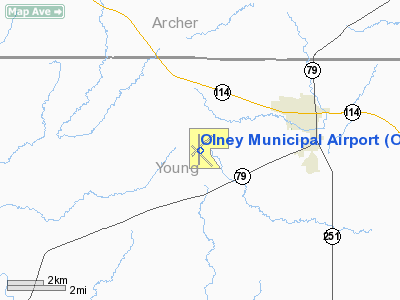
Location & QuickFacts
| FAA Information Effective: | 2008-09-25 |
| Airport Identifier: | ONY |
| Airport Status: | Operational |
| Longitude/Latitude: | 098-49-09.0000W/33-21-03.1700N
-98.819167/33.350881 (Estimated) |
| Elevation: | 1275 ft / 388.62 m (Surveyed) |
| Land: | 580 acres |
| From nearest city: | 3 nautical miles SW of Olney, TX |
| Location: | Young County, TX |
| Magnetic Variation: | 07E (1995) |
Owner & Manager
| Ownership: | Publicly owned |
| Owner: | City Of Olney |
| Address: | 201 East Main
Olney, TX 76374 |
| Phone number: | 940-564-2102 |
| Manager: | Dr. Robert G. Stark |
| Address: | Po Box 428
Olney, TX 76374 |
| Phone number: | 940-564-2938 |
Airport Operations and Facilities
| Airport Use: | Open to public |
| Wind indicator: | Yes |
| Segmented Circle: | Yes |
| Control Tower: | No |
| Lighting Schedule: | DUSK-DAWN |
| Beacon Color: | Clear-Green (lighted land airport) |
| Landing fee charge: | No |
| Sectional chart: | Dallas-ft Worth |
| Region: | ASW - Southwest |
| Boundary ARTCC: | ZFW - Fort Worth |
| Tie-in FSS: | FTW - Fort Worth |
| FSS on Airport: | No |
| FSS Phone: | 817-541-3474 |
| FSS Toll Free: | 1-800-WX-BRIEF |
| NOTAMs Facility: | FTW (NOTAM-d service avaliable) |
| Federal Agreements: | NPR3 |
Airport Communications
| CTAF: | 122.800 |
| Unicom: | 122.800 |
Airport Services
| Fuel available: | 100LL
SELF SERVICE FUEL AVBL 24 HRS WITH MAJOR CREDIT CARD. |
| Airframe Repair: | MAJOR |
| Power Plant Repair: | MAJOR |
| Bottled Oxygen: | NONE |
| Bulk Oxygen: | NONE |
Runway Information
Runway 04/22
| Dimension: | 5098 x 75 ft / 1553.9 x 22.9 m |
| Surface: | ASPH, Good Condition
COND-POOR; GRASS ON RY. |
| Weight Limit: | Single wheel: 43000 lbs.
Dual wheel: 50000 lbs.
Dual tandem wheel: 84000 lbs. |
| |
Runway 04 |
Runway 22 |
| Longitude: | 098-49-28.2840W | 098-48-45.5660W |
| Latitude: | 33-20-53.8260N | 33-21-29.2940N |
| Elevation: | 1264.00 ft | 1269.00 ft |
| Alignment: | 45 | 127 |
| Traffic Pattern: | Left | Left |
| Markings: | Basic, Fair Condition | Basic, Fair Condition |
| Obstruction: | 15 ft road, 775.0 ft from runway, 182 ft left of centerline, 38:1 slope to clear | , 50:1 slope to clear |
|
Runway 13/31
| Dimension: | 5096 x 150 ft / 1553.3 x 45.7 m |
| Surface: | ASPH, Poor Condition
COND-POOR; GRASS ON RY. |
| Weight Limit: | Single wheel: 43000 lbs.
Dual wheel: 50000 lbs.
Dual tandem wheel: 84000 lbs. |
| |
Runway 13 |
Runway 31 |
| Longitude: | 098-49-28.1700W | 098-48-45.9220W |
| Latitude: | 33-21-12.6760N | 33-20-36.8340N |
| Elevation: | 1271.00 ft | 1243.00 ft |
| Alignment: | 127 | 127 |
| Traffic Pattern: | Left | Left |
| Obstruction: | 15 ft road, 700.0 ft from runway, 175 ft right of centerline, 33:1 slope to clear | , 50:1 slope to clear |
|
Runway 17/35
| Dimension: | 5101 x 75 ft / 1554.8 x 22.9 m |
| Surface: | ASPH, Good Condition
COND-POOR; GRASS ON RY. |
| Weight Limit: | Single wheel: 43000 lbs.
Dual wheel: 50000 lbs.
Dual tandem wheel: 84000 lbs. |
| Edge Lights: | Medium |
| |
Runway 17 |
Runway 35 |
| Longitude: | 098-49-12.8350W | 098-49-13.1480W |
| Latitude: | 33-21-28.4250N | 33-20-37.9630N |
| Elevation: | 1275.00 ft | 1261.00 ft |
| Alignment: | 127 | 0 |
| Traffic Pattern: | Left | Left |
| Markings: | Non-precision instrument, Good Condition | Non-precision instrument, Good Condition |
| Crossing Height: | 52.00 ft | 28.00 ft |
| VASI: | 2-box on left side | 2-box on right side |
| Visual Glide Angle: | 3.00° | 3.00° |
| Obstruction: | 17 ft tree, 557.0 ft from runway, 30 ft right of centerline, 21:1 slope to clear | , 50:1 slope to clear |
|
Radio Navigation Aids
| ID |
Type |
Name |
Ch |
Freq |
Var |
Dist |
| ONY | NDB | Olney | | 272.00 | 07E | 0.2 nm |
| GHX | NDB | Graham | | 371.00 | 07E | 19.7 nm |
| SKB | NDB | Scotland | | 344.00 | 08E | 31.2 nm |
| GZV | NDB | Brazos River | | 280.00 | 07E | 31.5 nm |
| BKD | NDB | Breckenridge | | 245.00 | 07E | 36.5 nm |
| AKL | NDB | Haskell | | 407.00 | 08E | 46.3 nm |
| SHP | TACAN | Sheppard | 045X | | 10E | 41.4 nm |
| SPS | VORTAC | Wichita Falls | 074X | 112.70 | 10E | 39.9 nm |
Remarks
- HVY AGRI ACFT OPNS DRNG SPRING & SUMMER.
- RY 04/22 CENTER 1620 FT BY 75 FT OVERLAID WITH NO GRASS ENCROACHMENT.
- RY 13/31 CENTER 1600 FT BY 75 FT OVERLAID WITH NO GRASS ENCROACHMENT.
- AEROBATIC ACTIVITY ON ARPT.
- PRE-DATES ACT.
Images and information placed above are from
http://www.airport-data.com/airport/ONY/
We thank them for the data!
| General Info
|
| Country |
United States
|
| State |
TEXAS
|
| FAA ID |
ONY
|
| Latitude |
33-21-03.170N
|
| Longitude |
098-49-09.000W
|
| Elevation |
1275 feet
|
| Near City |
OLNEY
|
We don't guarantee the information is fresh and accurate. The data may
be wrong or outdated.
For more up-to-date information please refer to other sources.
|
|


