 |
|
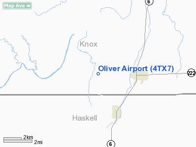
Location & QuickFacts
| FAA Information Effective: | 2008-09-25 |
| Airport Identifier: | 4TX7 |
| Airport Status: | Operational |
| Longitude/Latitude: | 099-51-56.3340W/33-25-10.3400N
-99.865648/33.419539 (Estimated) |
| Elevation: | 1500 ft / 457.20 m (Estimated) |
| Land: | 0 acres |
| From nearest city: | 3 nautical miles W of Knox City, TX |
| Location: | Knox County, TX |
| Magnetic Variation: | 08E (1985) |
Owner & Manager
| Ownership: | Privately owned |
| Owner: | Joann Asher |
| Address: | Route 2, Box 194b
Clyde, TX 79510-9627 |
| Address: |
|
Airport Operations and Facilities
| Airport Use: | Private |
| Wind indicator: | Yes |
| Segmented Circle: | No |
| Control Tower: | No |
| Landing fee charge: | No |
| Sectional chart: | Dallas-ft Worth |
| Region: | ASW - Southwest |
| Boundary ARTCC: | ZFW - Fort Worth |
| Tie-in FSS: | FTW - Fort Worth |
| FSS on Airport: | No |
| FSS Phone: | 817-541-3474 |
| FSS Toll Free: | 1-800-WX-BRIEF |
Airport Services
| Airframe Repair: | NONE |
| Power Plant Repair: | NONE |
Runway Information
Runway 09/27
| Dimension: | 2500 x 90 ft / 762.0 x 27.4 m |
| Surface: | TURF, |
| |
Runway 09 |
Runway 27 |
| Traffic Pattern: | Left | Left |
|
Radio Navigation Aids
| ID |
Type |
Name |
Ch |
Freq |
Var |
Dist |
| AKL | NDB | Haskell | | 407.00 | 08E | 15.6 nm |
| TMV | NDB | Stamford | | 290.00 | 08E | 33.8 nm |
| GTH | VORTAC | Guthrie | 092X | 114.50 | 10E | 31.9 nm |
Remarks
- BLDGS/TV TWRS NORTH & WEST OF RWY.
Images and information placed above are from
http://www.airport-data.com/airport/4TX7/
We thank them for the data!
| General Info
|
| Country |
United States
|
| State |
TEXAS
|
| FAA ID |
4TX7
|
| Latitude |
33-25-10.340N
|
| Longitude |
099-51-56.334W
|
| Elevation |
1500 feet
|
| Near City |
KNOX CITY
|
We don't guarantee the information is fresh and accurate. The data may
be wrong or outdated.
For more up-to-date information please refer to other sources.
|
|


