 |
|
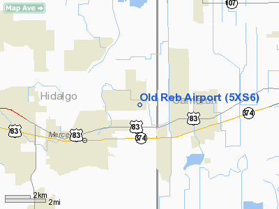
Location & QuickFacts
| FAA Information Effective: | 2008-09-25 |
| Airport Identifier: | 5XS6 |
| Airport Status: | Operational |
| Longitude/Latitude: | 097-52-30.9940W/26-10-31.2700N
-97.875276/26.175353 (Estimated) |
| Elevation: | 60 ft / 18.29 m (Estimated) |
| Land: | 120 acres |
| From nearest city: | 3 nautical miles NE of Mercedes, TX |
| Location: | Hidalgo County, TX |
| Magnetic Variation: | 07E (1985) |
Owner & Manager
| Ownership: | Privately owned |
| Owner: | William R. Sandlin |
| Address: | Rt 2, Box 153
Mercedes, TX 78570 |
| Phone number: | 210-565-1241 |
| Manager: | William R. Sandlin |
| Address: | Rt-4 Box 15111 Indian Hills
Mercedes, TX 78570 |
| Phone number: | 512-565-1241 |
Airport Operations and Facilities
| Airport Use: | Private |
| Wind indicator: | Yes |
| Segmented Circle: | No |
| Control Tower: | No |
| Landing fee charge: | No |
| Sectional chart: | Brownsville |
| Region: | ASW - Southwest |
| Boundary ARTCC: | ZHU - Houston |
| Tie-in FSS: | SJT - San Angelo |
| FSS on Airport: | No |
| FSS Toll Free: | 1-800-WX-BRIEF |
Airport Services
Runway Information
Runway 12/30
| Dimension: | 3000 x 40 ft / 914.4 x 12.2 m
NORTHWEST 200' 50' WIDE; NEXT 400' 25' WIDE; REMAINDER 40' WIDE. |
| Surface: | ASPH-TURF, Fair Condition
FIRST 500' NW END OF RWY - ASPH-G; REMAINDER OF RWY SFC LOOSE GRVL & TURF. NORTH TWY - GOOD CONDITON; SE TWY - VERY POOR CONDITION. |
| |
Runway 12 |
Runway 30 |
| Traffic Pattern: | Left | Left |
| Obstruction: | 10 ft road | 10 ft road, 0.0 ft from runway |
|
Radio Navigation Aids
| ID |
Type |
Name |
Ch |
Freq |
Var |
Dist |
| SNE | NDB | Santa Elena | | 260.00 | 07E | 49.9 nm |
| REX | VOR | Reynosa | | 112.40 | 08E | 21.5 nm |
| HRL | VOR/DME | Harlingen | 029X | 109.20 | 05E | 12.5 nm |
| MFE | VOR/DME | Mc Allen | 119X | 117.20 | 09E | 19.7 nm |
| MAM | VOR/DME | Matamoros | 090X | 114.30 | 07E | 30.9 nm |
| BRO | VORTAC | Brownsville | 110X | 116.30 | 09E | 30.9 nm |
Remarks
- PVT; N-S FARM AIRSTRIP 25 X 1800'; 850' NORTH OF NORTH E-W PROPERTY LINE.
- PRE DATES THE ACT. EXISTED PRIOR TO 1959.
Images and information placed above are from
http://www.airport-data.com/airport/5XS6/
We thank them for the data!
| General Info
|
| Country |
United States
|
| State |
TEXAS
|
| FAA ID |
5XS6
|
| Latitude |
26-10-31.270N
|
| Longitude |
097-52-30.994W
|
| Elevation |
60 feet
|
| Near City |
MERCEDES
|
We don't guarantee the information is fresh and accurate. The data may
be wrong or outdated.
For more up-to-date information please refer to other sources.
|
|


