 |
|
Location & QuickFacts
| FAA Information Effective: | 2008-09-25 |
| Airport Identifier: | TX24 |
| Airport Status: | Operational |
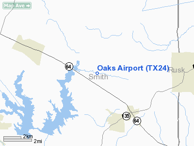
| Longitude/Latitude: | 095-05-00.7970W/32-16-30.5510N
-95.083555/32.275153 (Estimated) |
| Elevation: | 510 ft / 155.45 m (Estimated) |
| Land: | 0 acres |
| From nearest city: | 3 nautical miles NW of Arp, TX |
| Location: | Smith County, TX |
| Magnetic Variation: | 05E (1985) |
Owner & Manager
| Ownership: | Privately owned |
| Owner: | Thomas W Musselwhite |
| Address: | 19571 Hwy 64e
Arp, TX 75750-9764 |
| Phone number: | 214-859-7062 |
| Manager: | Thomas W Musselwhite |
| Address: | 19571 Hwy 64e
Arp, TX 75750-9764 |
| Phone number: | 214-859-7062 |
Airport Operations and Facilities
| Airport Use: | Private |
| Wind indicator: | Yes |
| Segmented Circle: | No |
| Control Tower: | No |
| Landing fee charge: | No |
| Sectional chart: | Dallas-ft Worth |
| Region: | ASW - Southwest |
| Boundary ARTCC: | ZFW - Fort Worth |
| Tie-in FSS: | FTW - Fort Worth |
| FSS on Airport: | No |
| FSS Phone: | 817-541-3474 |
| FSS Toll Free: | 1-800-WX-BRIEF |
Airport Services
| Airframe Repair: | NONE |
| Power Plant Repair: | NONE |
Runway Information
Runway 12/30
| Dimension: | 3000 x 100 ft / 914.4 x 30.5 m |
| Surface: | DIRT, |
| Edge Lights: | Low |
| |
Runway 12 |
Runway 30 |
| Traffic Pattern: | Left | Left |
| Obstruction: | 50 ft trees, 1000.0 ft from runway | 40 ft trees, 1000.0 ft from runway |
|
Radio Navigation Aids
| ID |
Type |
Name |
Ch |
Freq |
Var |
Dist |
| HNO | NDB | Henderson | | 371.00 | 06E | 12.5 nm |
| ABG | NDB | Ambassador | | 404.00 | 07E | 18.7 nm |
| TY | NDB | Tyler | | 320.00 | 06E | 21.3 nm |
| JSO | NDB | Cherokee County | | 263.00 | 05E | 25.3 nm |
| AHX | NDB | Athens | | 269.00 | 06E | 38.6 nm |
| RPF | NDB | Carthage | | 332.00 | 04E | 40.4 nm |
| GXD | NDB | Nacogdoches | | 391.00 | 05E | 42.3 nm |
| LST | NDB | Lone Star | | 305.00 | 05E | 42.9 nm |
| PSN | NDB | Palestine | | 375.00 | 04E | 43.3 nm |
| CSZ | NDB | Crossroads | | 215.00 | 08E | 46.3 nm |
| LIQ | NDB | Lochridge Ranch | | 335.00 | 09E | 47.0 nm |
| TYR | VOR/DME | Tyler | 089X | 114.20 | 06E | 17.0 nm |
| FZT | VOR/DME | Frankston | 051X | 111.40 | 06E | 25.7 nm |
| UIM | VOR/DME | Quitman | 087X | 114.00 | 08E | 39.1 nm |
| GGG | VORTAC | Gregg County | 070X | 112.30 | 07E | 18.8 nm |
Images and information placed above are from
http://www.airport-data.com/airport/TX24/
We thank them for the data!
| General Info
|
| Country |
United States
|
| State |
TEXAS
|
| FAA ID |
TX24
|
| Latitude |
32-16-30.551N
|
| Longitude |
095-05-00.797W
|
| Elevation |
510 feet
|
| Near City |
ARP
|
We don't guarantee the information is fresh and accurate. The data may
be wrong or outdated.
For more up-to-date information please refer to other sources.
|
|


