 |
|
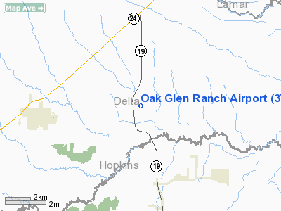
Location & QuickFacts
| FAA Information Effective: | 2008-09-25 |
| Airport Identifier: | 3TS9 |
| Airport Status: | Operational |
| Longitude/Latitude: | 095-36-12.8440W/33-22-45.3940N
-95.603568/33.379276 (Estimated) |
| Elevation: | 430 ft / 131.06 m (Estimated) |
| Land: | 8 acres |
| From nearest city: | 4 nautical miles E of Cooper, TX |
| Location: | Delta County, TX |
| Magnetic Variation: | 05E (1995) |
Owner & Manager
| Ownership: | Privately owned |
| Owner: | Larry O Calvin |
| Address: | Rt 1 Box 144
Cooper, TX 75432 |
| Phone number: | 903-395-2722 |
| Manager: | Larry O Calvin |
| Address: | Rt 1 Box 144
Cooper, TX 75432 |
| Phone number: | 903-395-2722 |
Airport Operations and Facilities
| Airport Use: | Private |
| Wind indicator: | Yes |
| Segmented Circle: | No |
| Control Tower: | No |
| Sectional chart: | Dallas-ft Worth |
| Region: | ASW - Southwest |
| Boundary ARTCC: | ZFW - Fort Worth |
| Tie-in FSS: | FTW - Fort Worth |
| FSS on Airport: | No |
| FSS Phone: | 817-541-3474 |
| FSS Toll Free: | 1-800-WX-BRIEF |
Runway Information
Runway 15/33
| Dimension: | 3000 x 80 ft / 914.4 x 24.4 m |
| Surface: | TURF, |
| |
Runway 15 |
Runway 33 |
| Traffic Pattern: | Left | Left |
|
Radio Navigation Aids
| ID |
Type |
Name |
Ch |
Freq |
Var |
Dist |
| HJM | NDB | Rayburn | | 415.00 | 06E | 32.0 nm |
| SYW | NDB | Cash | | 428.00 | 05E | 33.4 nm |
| MII | NDB | Caddo Mills | | 316.00 | 06E | 38.3 nm |
| HHW | NDB | Hugo | | 323.00 | 05E | 39.8 nm |
| AEE | NDB | Antlers | | 391.00 | 05E | 48.9 nm |
| AVZ | NDB | Travis | | 260.00 | 06E | 49.4 nm |
| IBO | NDB | Idabel | | 271.00 | 03E | 49.5 nm |
| MJF | TACAN | Arvilla | 033X | | 05E | 29.7 nm |
| SLR | VOR/DME | Sulphur Springs | 027X | 109.00 | 08E | 11.3 nm |
| PRX | VOR/DME | Paris | 083X | 113.60 | 07E | 12.5 nm |
| UIM | VOR/DME | Quitman | 087X | 114.00 | 08E | 32.3 nm |
| BYP | VORTAC | Bonham | 093X | 114.60 | 06E | 33.0 nm |
Images and information placed above are from
http://www.airport-data.com/airport/3TS9/
We thank them for the data!
| General Info
|
| Country |
United States
|
| State |
TEXAS
|
| FAA ID |
3TS9
|
| Latitude |
33-22-45.394N
|
| Longitude |
095-36-12.844W
|
| Elevation |
430 feet
|
| Near City |
COOPER
|
We don't guarantee the information is fresh and accurate. The data may
be wrong or outdated.
For more up-to-date information please refer to other sources.
|
|


