 |
|
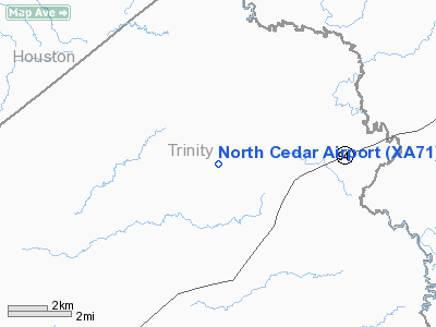
Location & QuickFacts
| FAA Information Effective: | 2008-09-25 |
| Airport Identifier: | XA71 |
| Airport Status: | Operational |
| Longitude/Latitude: | 094-58-26.4000W/31-16-38.4000N
-94.974000/31.277333 (Estimated) |
| Elevation: | 250 ft / 76.20 m (Estimated) |
| Land: | 0 acres |
| From nearest city: | 3 nautical miles N of Apple Springs, TX |
| Location: | Trinity County, TX |
| Magnetic Variation: | () |
Owner & Manager
| Ownership: | Privately owned |
| Owner: | Rickey W. Hendry |
| Address: | Po Box 63
Apple Springs, TX 75926 |
| Phone number: | 936-831-3465 |
| Manager: | Rickey W. Hendry |
| Address: | Po Box 63
Apple Springs, TX 75926 |
| Phone number: | 936-831-3465 |
Airport Operations and Facilities
| Airport Use: | Private |
| Wind indicator: | Yes |
| Control Tower: | No |
| Sectional chart: | Houston |
| Region: | ASW - Southwest |
| Boundary ARTCC: | ZHU - Houston |
| Tie-in FSS: | CXO - Montgomery County |
| FSS Toll Free: | 1-800-WX-BRIEF |
Runway Information
Runway 17/35
| Dimension: | 2400 x 75 ft / 731.5 x 22.9 m |
| Surface: | TURF, |
| |
Runway 17 |
Runway 35 |
| Traffic Pattern: | Left | Left |
|
Radio Navigation Aids
| ID |
Type |
Name |
Ch |
Freq |
Var |
Dist |
| OC | NDB | Nados | | 253.00 | 05E | 18.1 nm |
| GXD | NDB | Nacogdoches | | 391.00 | 05E | 26.2 nm |
| JSO | NDB | Cherokee County | | 263.00 | 05E | 37.7 nm |
| UTS | NDB | Huntsville | | 308.00 | 06E | 45.3 nm |
| PSN | NDB | Palestine | | 375.00 | 04E | 48.0 nm |
| LFK | VORTAC | Lufkin | 058X | 112.10 | 05E | 14.9 nm |
Images and information placed above are from
http://www.airport-data.com/airport/XA71/
We thank them for the data!
|
|


