 |
|
Location & QuickFacts
| FAA Information Effective: | 2008-09-25 |
| Airport Identifier: | TS62 |
| Airport Status: | Operational |
| Longitude/Latitude: | 100-31-06.4090W/33-12-00.3390N
-100.518447/33.200094 (Estimated) |
| Elevation: | 1987 ft / 605.64 m (Estimated) |
| Land: | 10 acres |
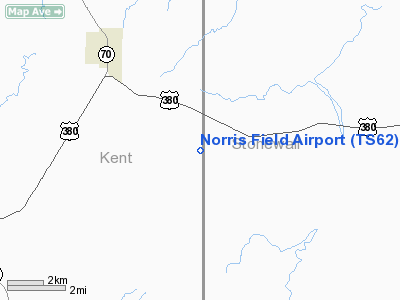
| From nearest city: | 4 nautical miles SE of Jayton, TX |
| Location: | Kent County, TX |
| Magnetic Variation: | 08E (1985) |
Owner & Manager
| Ownership: | Privately owned |
| Owner: | Mike Norris |
| Address: | Box 173
Jayton, TX 79528 |
| Phone number: | 806-237-9061 |
| Manager: | Mike Norris |
| Address: | Box 173
Jayton, TX 79528 |
Airport Operations and Facilities
| Airport Use: | Private |
| Segmented Circle: | No |
| Control Tower: | No |
| Sectional chart: | Dallas-ft Worth |
| Region: | ASW - Southwest |
| Boundary ARTCC: | ZFW - Fort Worth |
| Tie-in FSS: | FTW - Fort Worth |
| FSS Phone: | 817-541-3474 |
| FSS Toll Free: | 1-800-WX-BRIEF |
Runway Information
Runway 17/35
| Dimension: | 2600 x 50 ft / 792.5 x 15.2 m |
| Surface: | TURF, |
| |
Runway 17 |
Runway 35 |
| Traffic Pattern: | Left | Left |
|
Radio Navigation Aids
| ID |
Type |
Name |
Ch |
Freq |
Var |
Dist |
| SDR | NDB | Snyder | | 359.00 | 08E | 36.9 nm |
| AKL | NDB | Haskell | | 407.00 | 08E | 40.2 nm |
| CZX | NDB | Crosbyton | | 332.00 | 09E | 44.2 nm |
| TMV | NDB | Stamford | | 290.00 | 08E | 44.3 nm |
| SWW | NDB | Sweetwater | | 275.00 | 08E | 44.5 nm |
| GTH | VORTAC | Guthrie | 092X | 114.50 | 10E | 35.9 nm |
Images and information placed above are from
http://www.airport-data.com/airport/TS62/
We thank them for the data!
| General Info
|
| Country |
United States
|
| State |
TEXAS
|
| FAA ID |
TS62
|
| Latitude |
33-12-00.339N
|
| Longitude |
100-31-06.409W
|
| Elevation |
1987 feet
|
| Near City |
JAYTON
|
We don't guarantee the information is fresh and accurate. The data may
be wrong or outdated.
For more up-to-date information please refer to other sources.
|
|


