 |
|
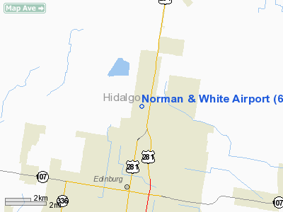
Location & QuickFacts
| FAA Information Effective: | 2008-09-25 |
| Airport Identifier: | 6TE1 |
| Airport Status: | Operational |
| Longitude/Latitude: | 098-09-09.0340W/26-21-41.2480N
-98.152509/26.361458 (Estimated) |
| Elevation: | 90 ft / 27.43 m (Estimated) |
| Land: | 0 acres |
| From nearest city: | 3 nautical miles N of Edinburg, TX |
| Location: | Hidalgo County, TX |
| Magnetic Variation: | 07E (1985) |
Owner & Manager
| Ownership: | Privately owned |
| Owner: | H. B. White |
| Address: | P.o. Box 569
Edinburg, TX 78540 |
| Phone number: | 512-383-2311 |
| Address: |
|
Airport Operations and Facilities
| Airport Use: | Private |
| Wind indicator: | Yes |
| Segmented Circle: | No |
| Control Tower: | No |
| Landing fee charge: | No |
| Sectional chart: | Brownsville |
| Region: | ASW - Southwest |
| Boundary ARTCC: | ZHU - Houston |
| Tie-in FSS: | SJT - San Angelo |
| FSS on Airport: | No |
| FSS Toll Free: | 1-800-WX-BRIEF |
Airport Services
| Fuel available: | 100 |
| Airframe Repair: | MINOR |
| Power Plant Repair: | MINOR |
Runway Information
Runway 09/27
| Dimension: | 4000 x 300 ft / 1219.2 x 91.4 m |
| Surface: | TURF-DIRT,
3000 X 45' CALICHE STRIP DOWN CENTER OF RWY FOR WET WEATHER OPERATION. |
| |
Runway 09 |
Runway 27 |
| Traffic Pattern: | Right | Left |
|
Radio Navigation Aids
| ID |
Type |
Name |
Ch |
Freq |
Var |
Dist |
| SNE | NDB | Santa Elena | | 260.00 | 07E | 31.4 nm |
| REX | VOR | Reynosa | | 112.40 | 08E | 21.4 nm |
| MFE | VOR/DME | Mc Allen | 119X | 117.20 | 09E | 12.2 nm |
| HRL | VOR/DME | Harlingen | 029X | 109.20 | 05E | 28.1 nm |
| MAM | VOR/DME | Matamoros | 090X | 114.30 | 07E | 49.1 nm |
| BRO | VORTAC | Brownsville | 110X | 116.30 | 09E | 49.5 nm |
Remarks
- AG ACFT OPERG NON-STD TFC PTN-LAND AT OWN RISK. DEPG ACFT HAVE RIGHT-OF-WAY.
- LIGHT AIRCRAFT & ULTRA-LIGHT STRIP 1/4 MI. N.
- MAY BE EXEMPT UNDER GRANDFATHER CLAUSE
Images and information placed above are from
http://www.airport-data.com/airport/6TE1/
We thank them for the data!
| General Info
|
| Country |
United States
|
| State |
TEXAS
|
| FAA ID |
6TE1
|
| Latitude |
26-21-41.248N
|
| Longitude |
098-09-09.034W
|
| Elevation |
90 feet
|
| Near City |
EDINBURG
|
We don't guarantee the information is fresh and accurate. The data may
be wrong or outdated.
For more up-to-date information please refer to other sources.
|
|


