 |
|
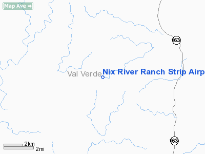
Nix River Ranch Strip Airport |
Location & QuickFacts
| FAA Information Effective: | 2008-09-25 |
| Airport Identifier: | TX07 |
| Airport Status: | Operational |
| Longitude/Latitude: | 101-14-03.3000W/29-56-03.4000N
-101.234250/29.934278 (Estimated) |
| Elevation: | 1820 ft / 554.74 m (Estimated) |
| Land: | 21000 acres |
| From nearest city: | 20 nautical miles N of Comstock, TX |
| Location: | Val Verde County, TX |
| Magnetic Variation: | 08E (2000) |
Owner & Manager
| Ownership: | Privately owned |
| Owner: | Harold Nix |
| Address: | 13386 Fm 557
Pittsburg, TX 75686-5455 |
| Phone number: | 903-645-7333 |
| Manager: | Gerry Klingman |
| Address: | Rt 3 Gregg Co Airport
Longview, TX 75603 |
| Phone number: | 903-235-5105 |
Airport Operations and Facilities
| Airport Use: | Private |
| Wind indicator: | Yes |
| Segmented Circle: | No |
| Control Tower: | No |
| Sectional chart: | San Antonio |
| Region: | ASW - Southwest |
| Boundary ARTCC: | ZHU - Houston |
| Tie-in FSS: | SJT - San Angelo |
| FSS Toll Free: | 1-800-WX-BRIEF |
Airport Communications
Runway Information
Runway 16/34
| Dimension: | 6000 x 75 ft / 1828.8 x 22.9 m |
| Surface: | ASPH, |
| |
Runway 16 |
Runway 34 |
| Traffic Pattern: | Left | Left |
| Obstruction: | 10 ft fence, 100.0 ft from runway | 10 ft fence, 100.0 ft from runway |
|
Radio Navigation Aids
| ID |
Type |
Name |
Ch |
Freq |
Var |
Dist |
| SOA | NDB | Sonora | | 371.00 | 08E | 49.4 nm |
| DLF | VORTAC | Laughlin | 091X | 114.40 | 07E | 42.1 nm |
| RSG | VORTAC | Rocksprings | 049X | 111.20 | 10E | 48.9 nm |
Images and information placed above are from
http://www.airport-data.com/airport/TX07/
We thank them for the data!
| General Info
|
| Country |
United States
|
| State |
TEXAS
|
| FAA ID |
TX07
|
| Latitude |
29-56-03.400N
|
| Longitude |
101-14-03.300W
|
| Elevation |
1820 feet
|
| Near City |
COMSTOCK
|
We don't guarantee the information is fresh and accurate. The data may
be wrong or outdated.
For more up-to-date information please refer to other sources.
|
|


