 |
|
Location & QuickFacts
| FAA Information Effective: | 2008-09-25 |
| Airport Identifier: | 61R |
| Airport Status: | Operational |
| Longitude/Latitude: | 093-44-30.6410W/30-53-03.7170N
-93.741845/30.884366 (Estimated) |
| Elevation: | 320 ft / 97.54 m (Estimated) |
| Land: | 92 acres |
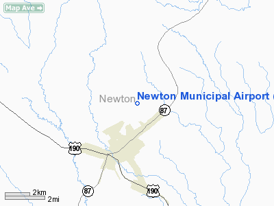
| From nearest city: | 3 nautical miles NE of Newton, TX |
| Location: | Newton County, TX |
| Magnetic Variation: | 05E (1985) |
Owner & Manager
| Ownership: | Publicly owned |
| Owner: | Newton County |
| Address: | Po Box J
Newton, TX 75966 |
| Phone number: | 409-379-5691 |
| Manager: | Burnett Low |
| Address: | Po Box 89
Burkeville, TX 75932 |
| Phone number: | 409-379-5737 |
Airport Operations and Facilities
| Airport Use: | Open to public |
| Wind indicator: | Yes |
| Segmented Circle: | Yes |
| Control Tower: | No |
| Lighting Schedule: | DUSK-DAWN |
| Beacon Color: | Clear-Green (lighted land airport)
ROTG BCN OTS INDEFLY. |
| Landing fee charge: | No |
| Sectional chart: | Houston |
| Region: | ASW - Southwest |
| Boundary ARTCC: | ZHU - Houston |
| Tie-in FSS: | CXO - Montgomery County |
| FSS on Airport: | No |
| FSS Toll Free: | 1-800-WX-BRIEF
FOR FP FILING CALL CXO FSS 1-800-833-5602. |
| NOTAMs Facility: | CXO (NOTAM-d service avaliable) |
Airport Communications
| CTAF: | 122.800 |
| Unicom: | 122.800 |
Airport Services
| Bottled Oxygen: | NONE |
| Bulk Oxygen: | NONE |
Runway Information
Runway 14/32
| Dimension: | 4000 x 60 ft / 1219.2 x 18.3 m |
| Surface: | ASPH, Good Condition |
| Weight Limit: | Single wheel: 12500 lbs. |
| Edge Lights: | Low |
| |
Runway 14 |
Runway 32 |
| Traffic Pattern: | Left | Left |
| Markings: | Basic, Good Condition | Basic, Good Condition |
| Obstruction: | 60 ft trees, 1650.0 ft from runway, 150 ft right of centerline, 24:1 slope to clear | 55 ft tree, 976.0 ft from runway, 170 ft left of centerline, 14:1 slope to clear |
|
Radio Navigation Aids
| ID |
Type |
Name |
Ch |
Freq |
Var |
Dist |
| POE1 | FAN MARKER | North | | | 07E | 30.1 nm |
| POE | FAN MARKER | South | | | 07E | 30.4 nm |
| JAS | NDB | Jasper | | 344.00 | 04E | 15.6 nm |
| DR | NDB | Idder | | 385.00 | 04E | 22.5 nm |
| VED | NDB | Leesville | | 247.00 | 04E | 24.4 nm |
| GUV | NDB | Gator | | 359.00 | 05E | 30.0 nm |
| DQU | NDB | De Quincy | | 410.00 | 05E | 30.5 nm |
| HRD | NDB | Hardin County | | 524.00 | 04E | 42.4 nm |
| MMY | NDB | Many | | 272.00 | 04E | 42.6 nm |
| UX | NDB | Sulfy | | 278.00 | 04E | 44.5 nm |
| ORG | NDB | Orange | | 211.00 | 05E | 49.0 nm |
| FXU | VORTAC | Polk | 021X | 108.40 | 05E | 30.3 nm |
Images and information placed above are from
http://www.airport-data.com/airport/61R/
We thank them for the data!
| General Info
|
| Country |
United States
|
| State |
TEXAS
|
| FAA ID |
61R
|
| Latitude |
30-53-03.717N
|
| Longitude |
093-44-30.641W
|
| Elevation |
320 feet
|
| Near City |
NEWTON
|
We don't guarantee the information is fresh and accurate. The data may
be wrong or outdated.
For more up-to-date information please refer to other sources.
|
|


