 |
|
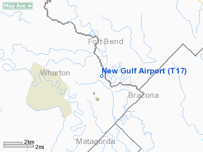
Location & QuickFacts
| FAA Information Effective: | 2008-09-25 |
| Airport Identifier: | T17 |
| Airport Status: | Operational |
| Longitude/Latitude: | 095-53-19.0000W/29-16-34.0000N
-95.888611/29.276111 (Estimated) |
| Elevation: | 100 ft / 30.48 m (Estimated) |
| Land: | 50 acres |
| From nearest city: | 2 nautical miles E of New Gulf, TX |
| Location: | Wharton County, TX |
| Magnetic Variation: | () |
Owner & Manager
| Ownership: | Privately owned |
| Owner: | H & L New Gulf |
| Address: | 132 Ave G
New Gulf, TX 77462 |
| Phone number: | 979-657-8211 |
| Manager: | Bob Jackson |
| Address: | Hangar 1
New Gulf, TX 77462 |
| Phone number: | 979-657-8211 |
Airport Operations and Facilities
| Airport Use: | Open to public |
| Wind indicator: | Yes |
| Segmented Circle: | No |
| Control Tower: | No |
| Sectional chart: | Houston |
| Region: | ASW - Southwest |
| Boundary ARTCC: | ZHU - Houston |
| Tie-in FSS: | CXO - Montgomery County |
| FSS Toll Free: | 1-800-WX-BRIEF |
| NOTAMs Facility: | CXO (NOTAM-d service avaliable) |
Airport Communications
| CTAF: | 122.800 |
| Unicom: | 122.800 |
Airport Services
Runway Information
Runway 15/33
| Dimension: | 4400 x 75 ft / 1341.1 x 22.9 m |
| Surface: | ASPH, |
| |
Runway 15 |
Runway 33 |
| Traffic Pattern: | Left | Left |
| Obstruction: | | 20 ft pline, 900.0 ft from runway |
|
Radio Navigation Aids
| ID |
Type |
Name |
Ch |
Freq |
Var |
Dist |
| ARM | NDB | Wharton | | 245.00 | 06E | 13.9 nm |
| BYY | NDB | Bay City | | 344.00 | 06E | 18.3 nm |
| SGR | NDB | Hull | | 388.00 | 05E | 24.6 nm |
| SYG | NDB | Sandy Point | | 402.00 | 05E | 25.9 nm |
| LYD | NDB | Lakeside | | 249.00 | 05E | 34.3 nm |
| EYQ | NDB | Weiser | | 286.00 | 06E | 41.6 nm |
| JPA | NDB | Sanjac | | 347.00 | 05E | 48.9 nm |
| EFD | TACAN | Ellington | 031X | | 05E | 43.0 nm |
| ELA | VOR/DME | Eagle Lake | 111X | 116.40 | 08E | 32.3 nm |
| HUB | VOR/DME | Hobby | 118X | 117.10 | 05E | 39.3 nm |
| PSX | VORTAC | Palacios | 120X | 117.30 | 08E | 37.8 nm |
| IAH | VORTAC | Humble | 113X | 116.60 | 05E | 49.8 nm |
| HOU | VOT | Houston Wm P Hobby | | 108.40 | | 38.9 nm |
Remarks
- PRVDD FTW FPO AT LEAST 9 MONTHS PRIOR TO DATE THAT INSTRUMENT PROCEDURES ARE ANTICIPATED.
Images and information placed above are from
http://www.airport-data.com/airport/T17/
We thank them for the data!
| General Info
|
| Country |
United States
|
| State |
TEXAS
|
| FAA ID |
T17
|
| Latitude |
29.276111
29° 16' 34.00" N
|
| Longitude |
-95.888611
095° 53' 19.00" W
|
| Elevation |
100 feet
30 meters
|
| Magnetic Variation |
004° E (01/06)
|
| Operating Agency |
U.S.CIVIL AIRPORT WHEREIN PERMIT COVERS USE BY TRANSIT MILITARY AIRCRAFT
|
We don't guarantee the information is fresh and accurate. The data may
be wrong or outdated.
For more up-to-date information please refer to other sources.
|
|


