 |
|
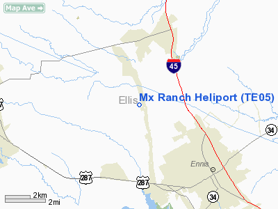
Location & QuickFacts
| FAA Information Effective: | 2008-09-25 |
| Airport Identifier: | TE05 |
| Airport Status: | Operational |
| Longitude/Latitude: | 096-41-13.0000W/32-22-45.0000N
-96.686944/32.379167 (Estimated) |
| Elevation: | 500 ft / 152.40 m (Estimated) |
| Land: | 0 acres |
| From nearest city: | 7 nautical miles SE of Ennis, TX |
| Location: | Ellis County, TX |
| Magnetic Variation: | () |
Owner & Manager
| Ownership: | Privately owned |
| Owner: | Frank M. Bartolic |
| Address: | Po Box 1384
Ennis, TX 75120 |
| Phone number: | 972-878-8592 |
| Manager: | Frank M. Bartolic |
| Address: | Po Box 1384
Ennis, TX 75120 |
| Phone number: | 214-578-9248 |
Airport Operations and Facilities
| Airport Use: | Private |
| Control Tower: | No |
| Sectional chart: | Dallas-ft Worth |
| Region: | ASW - Southwest |
| Boundary ARTCC: | ZFW - Fort Worth |
| Tie-in FSS: | FTW - Fort Worth |
| FSS Phone: | 817-541-3474 |
| FSS Toll Free: | 1-800-WX-BRIEF |
Runway Information
Helipad H1
| Dimension: | 100 x 100 ft / 30.5 x 30.5 m |
| Surface: | TURF, |
| |
Runway H1 |
Runway |
| Traffic Pattern: | Left | Left |
|
Radio Navigation Aids
| ID |
Type |
Name |
Ch |
Freq |
Var |
Dist |
| LNC | NDB | Lancaster | | 239.00 | 06E | 12.1 nm |
| JUG | NDB | Jecca | | 388.00 | 06E | 19.1 nm |
| XQH | NDB | Cedar Hill | | 353.00 | 08E | 19.4 nm |
| RBD | NDB | Redbird | | 287.00 | 06E | 20.2 nm |
| CGQ | NDB | Powell | | 344.00 | 06E | 23.1 nm |
| CRS | NDB | Corsicana | | 396.00 | 06E | 25.8 nm |
| PQF | NDB | Mesquite | | 248.00 | 06E | 27.1 nm |
| AVZ | NDB | Travis | | 260.00 | 06E | 31.9 nm |
| PYF | NDB | Pyramid | | 418.00 | 06E | 39.8 nm |
| CSZ | NDB | Crossroads | | 215.00 | 08E | 41.7 nm |
| LIQ | NDB | Lochridge Ranch | | 335.00 | 09E | 43.4 nm |
| LXY | NDB | Mexia | | 329.00 | 07E | 45.3 nm |
| AHX | NDB | Athens | | 269.00 | 06E | 45.5 nm |
| MII | NDB | Caddo Mills | | 316.00 | 06E | 45.5 nm |
| SYW | NDB | Cash | | 428.00 | 05E | 47.9 nm |
| NFW | TACAN | Nas Jrb Fort Worth | 024X | | 07E | 44.8 nm |
| CVE | VOR/DME | Cowboy | 109X | 116.20 | 06E | 32.6 nm |
| TTT | VOR/DME | Maverick | 078X | 113.10 | 06E | 34.5 nm |
| GNL | VOR/DME | Groesbeck | 025X | 108.80 | 05E | 48.5 nm |
| CQY | VORTAC | Cedar Creek | 095X | 114.80 | 06E | 26.5 nm |
| FUZ | VORTAC | Ranger | 104X | 115.70 | 06E | 39.5 nm |
| DAL | VOT | Dallas Love Field | | 113.30 | | 29.3 nm |
| FTW | VOT | Fort Worth Meacham | | 108.20 | | 43.0 nm |
Remarks
- PRVDD PVT USE ONLY; VFR OPERATIONS ONLY; AND ALL INGRESS ROUTES HAVE A CLEAR 8:1 VISUAL APCH SLOPE.
Images and information placed above are from
http://www.airport-data.com/airport/TE05/
We thank them for the data!
| General Info
|
| Country |
United States
|
| State |
TEXAS
|
| FAA ID |
TE05
|
| Latitude |
29-06-00.881N
|
| Longitude |
098-26-55.053W
|
| Elevation |
500 feet
|
| Near City |
LEMING
|
We don't guarantee the information is fresh and accurate. The data may
be wrong or outdated.
For more up-to-date information please refer to other sources.
|
|


