 |
|
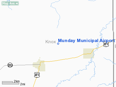
Location & QuickFacts
| FAA Information Effective: | 2008-09-25 |
| Airport Identifier: | 37F |
| Airport Status: | Operational |
| Longitude/Latitude: | 099-35-10.3040W/33-29-05.3430N
-99.586196/33.484817 (Estimated) |
| Elevation: | 1473 ft / 448.97 m (Estimated) |
| Land: | 80 acres |
| From nearest city: | 3 nautical miles E of Munday, TX |
| Location: | Knox County, TX |
| Magnetic Variation: | 08E (1985) |
Owner & Manager
| Ownership: | Publicly owned |
| Owner: | City Of Munday |
| Address: | Drawer 39
Munday, TX 76371 |
| Phone number: | 940-422-4331 |
| Manager: | Dwayne Bearden
CITY ADMINISTRATOR |
| Address: | Drawer 39
Munday, TX 76371 |
| Phone number: | 940-422-4331 |
Airport Operations and Facilities
| Airport Use: | Open to public |
| Wind indicator: | Yes |
| Segmented Circle: | Yes |
| Control Tower: | No |
| Lighting Schedule: | DUSK-DAWN |
| Beacon Color: | Clear-Green (lighted land airport) |
| Sectional chart: | Dallas-ft Worth |
| Region: | ASW - Southwest |
| Boundary ARTCC: | ZFW - Fort Worth |
| Tie-in FSS: | FTW - Fort Worth |
| FSS on Airport: | No |
| FSS Phone: | 817-541-3474 |
| FSS Toll Free: | 1-800-WX-BRIEF |
| NOTAMs Facility: | FTW (NOTAM-d service avaliable) |
| Federal Agreements: | 1Y |
Airport Communications
Airport Services
| Fuel available: | 100LLA |
| Airframe Repair: | NONE |
| Power Plant Repair: | NONE |
| Bottled Oxygen: | NONE |
| Bulk Oxygen: | NONE |
Runway Information
Runway 17/35
| Dimension: | 3200 x 50 ft / 975.4 x 15.2 m |
| Surface: | ASPH, Good Condition |
| Weight Limit: | Single wheel: 4000 lbs. |
| Edge Lights: | Low |
| |
Runway 17 |
Runway 35 |
| Traffic Pattern: | Left | Left |
| Markings: | Basic, Good Condition | Basic, Good Condition |
| Obstruction: | , 50:1 slope to clear | 60 ft pline, 3100.0 ft from runway, 48:1 slope to clear |
|
Radio Navigation Aids
| ID |
Type |
Name |
Ch |
Freq |
Var |
Dist |
| AKL | NDB | Haskell | | 407.00 | 08E | 18.9 nm |
| TMV | NDB | Stamford | | 290.00 | 08E | 37.8 nm |
| ONY | NDB | Olney | | 272.00 | 07E | 39.5 nm |
| VRT | NDB | Wilbarger | | 230.00 | 08E | 47.1 nm |
| GTH | VORTAC | Guthrie | 092X | 114.50 | 10E | 41.5 nm |
Images and information placed above are from
http://www.airport-data.com/airport/37F/
We thank them for the data!
| General Info
|
| Country |
United States
|
| State |
TEXAS
|
| FAA ID |
37F
|
| Latitude |
33-29-05.343N
|
| Longitude |
099-35-10.304W
|
| Elevation |
1473 feet
|
| Near City |
MUNDAY
|
We don't guarantee the information is fresh and accurate. The data may
be wrong or outdated.
For more up-to-date information please refer to other sources.
|
|


