 |
|
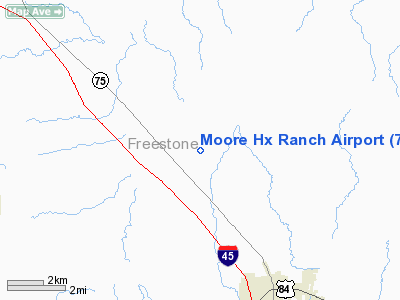
Location & QuickFacts
| FAA Information Effective: | 2008-09-25 |
| Airport Identifier: | 7XS6 |
| Airport Status: | Operational |
| Longitude/Latitude: | 096-12-28.7000W/31-47-40.0000N
-96.207972/31.794444 (Estimated) |
| Elevation: | 400 ft / 121.92 m (Estimated) |
| Land: | 0 acres |
| From nearest city: | 5 nautical miles NW of Fairfield, TX |
| Location: | Freestone County, TX |
| Magnetic Variation: | 06E (1995) |
Owner & Manager
| Ownership: | Privately owned |
| Owner: | Harold R Moore |
| Address: | 764 W Commerce
Fairfield, TX 75840 |
| Phone number: | 903-389-4151 |
| Manager: | Harold R Moore |
| Address: | 764 W Commerce
Fairfield, TX 75840 |
| Phone number: | 903-389-4151 |
Airport Operations and Facilities
| Airport Use: | Private |
| Segmented Circle: | No |
| Control Tower: | No |
| Sectional chart: | Houston |
| Region: | ASW - Southwest |
| Boundary ARTCC: | ZFW - Fort Worth |
| Tie-in FSS: | FTW - Fort Worth |
| FSS on Airport: | No |
| FSS Phone: | 817-541-3474 |
| FSS Toll Free: | 1-800-WX-BRIEF |
Runway Information
Runway 17/35
| Dimension: | 2500 x 75 ft / 762.0 x 22.9 m |
| Surface: | TURF, |
| |
Runway 17 |
Runway 35 |
| Traffic Pattern: | Left | Left |
| Obstruction: | 40 ft trees, 900.0 ft from runway | 40 ft trees, 500.0 ft from runway |
|
Radio Navigation Aids
| ID |
Type |
Name |
Ch |
Freq |
Var |
Dist |
| PYF | NDB | Pyramid | | 418.00 | 06E | 4.1 nm |
| CRS | NDB | Corsicana | | 396.00 | 06E | 17.0 nm |
| LXY | NDB | Mexia | | 329.00 | 07E | 18.1 nm |
| LIQ | NDB | Lochridge Ranch | | 335.00 | 09E | 18.4 nm |
| CGQ | NDB | Powell | | 344.00 | 06E | 19.7 nm |
| CSZ | NDB | Crossroads | | 215.00 | 08E | 20.6 nm |
| PSN | NDB | Palestine | | 375.00 | 04E | 25.9 nm |
| AHX | NDB | Athens | | 269.00 | 06E | 29.2 nm |
| ROB | NDB | Robinson | | 400.00 | 07E | 47.4 nm |
| GNL | VOR/DME | Groesbeck | 025X | 108.80 | 05E | 21.6 nm |
| FZT | VOR/DME | Frankston | 051X | 111.40 | 06E | 38.4 nm |
| CQY | VORTAC | Cedar Creek | 095X | 114.80 | 06E | 23.5 nm |
| LOA | VORTAC | Leona | 045X | 110.80 | 08E | 42.1 nm |
Images and information placed above are from
http://www.airport-data.com/airport/7XS6/
We thank them for the data!
| General Info
|
| Country |
United States
|
| State |
TEXAS
|
| FAA ID |
7XS6
|
| Latitude |
31-47-40.000N
|
| Longitude |
096-12-28.700W
|
| Elevation |
400 feet
|
| Near City |
FAIRFIELD
|
We don't guarantee the information is fresh and accurate. The data may
be wrong or outdated.
For more up-to-date information please refer to other sources.
|
|


