 |
|
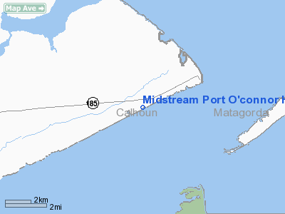
Midstream Port O'connor Heliport |
Location & QuickFacts
| FAA Information Effective: | 2008-09-25 |
| Airport Identifier: | XA81 |
| Airport Status: | Operational |
| Longitude/Latitude: | 096-26-58.0000W/28-25-35.0000N
-96.449444/28.426389 (Estimated) |
| Elevation: | 7 ft / 2.13 m (Estimated) |
| Land: | 0 acres |
| From nearest city: | 1 nautical miles W of Port O'connor, TX |
| Location: | Calhoun County, TX |
| Magnetic Variation: | () |
Owner & Manager
| Ownership: | Privately owned |
| Owner: | Martin Midstream Partnership |
| Address: | 5900 Memorial Drive, Suite 305
Houston, TX 77007 |
| Phone number: | 713-350-6800 |
| Manager: | Jon Sheridon |
| Address: | Po Box 428
Port O'connor, TX 77982 |
| Phone number: | 361-983-2631 |
Airport Operations and Facilities
| Airport Use: | Private |
| Wind indicator: | Yes |
| Control Tower: | No |
| Sectional chart: | Houston |
| Region: | ASW - Southwest |
| Boundary ARTCC: | ZHU - Houston |
| Tie-in FSS: | CXO - Montgomery County |
| FSS Toll Free: | 1-800-WX-BRIEF |
Runway Information
Helipad H1
| Dimension: | 30 x 30 ft / 9.1 x 9.1 m |
| Surface: | CONC, |
| |
Runway H1 |
Runway |
| Traffic Pattern: | Left | Left |
|
Helipad H2
| Dimension: | 50 x 50 ft / 15.2 x 15.2 m |
| Surface: | CONC, |
| |
Runway H2 |
Runway |
| Traffic Pattern: | Left | Left |
|
Radio Navigation Aids
| ID |
Type |
Name |
Ch |
Freq |
Var |
Dist |
| PKV | NDB | Port Lavaca | | 515.00 | 05E | 18.2 nm |
| RKP | NDB | Rockport | | 391.00 | 06E | 37.5 nm |
| MNO | NDB | Mellon Ranch | | 375.00 | 06E | 41.0 nm |
| BYY | NDB | Bay City | | 344.00 | 06E | 45.2 nm |
| VCT | VOR/DME | Victoria | 027X | 109.00 | 06E | 39.9 nm |
| PSX | VORTAC | Palacios | 120X | 117.30 | 08E | 21.7 nm |
Images and information placed above are from
http://www.airport-data.com/airport/XA81/
We thank them for the data!
|
|


