 |
|
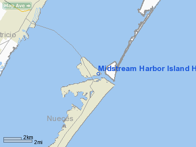
Midstream Harbor Island Heliport |
Location & QuickFacts
| FAA Information Effective: | 2008-09-25 |
| Airport Identifier: | XA80 |
| Airport Status: | Operational |
| Longitude/Latitude: | 097-03-47.0000W/27-50-47.0000N
-97.063056/27.846389 (Estimated) |
| Elevation: | 8 ft / 2.44 m (Estimated) |
| Land: | 0 acres |
| From nearest city: | 1 nautical miles W of Port Aransas, TX |
| Location: | San Patricio County, TX |
| Magnetic Variation: | () |
Owner & Manager
| Ownership: | Privately owned |
| Owner: | Martin Midstream Partnership |
| Address: | 5900 Memorial Drive
Houston, TX 77007 |
| Phone number: | 713-350-6800 |
| Manager: | Kenny Constance |
| Address: | Po Box 1749
Aransas Pass, TX 78336 |
| Phone number: | 361-758-0296 |
Airport Operations and Facilities
| Airport Use: | Private |
| Wind indicator: | Yes |
| Control Tower: | No |
| Sectional chart: | Brownsville |
| Region: | ASW - Southwest |
| Boundary ARTCC: | ZHU - Houston |
| Tie-in FSS: | SJT - San Angelo |
| FSS Toll Free: | 1-800-WX-BRIEF |
Runway Information
Helipad H1
| Dimension: | 60 x 60 ft / 18.3 x 18.3 m |
| Surface: | CONC, |
| |
Runway H1 |
Runway |
| Traffic Pattern: | Left | Left |
|
Radio Navigation Aids
| ID |
Type |
Name |
Ch |
Freq |
Var |
Dist |
| RKP | NDB | Rockport | | 391.00 | 06E | 14.7 nm |
| MNO | NDB | Mellon Ranch | | 375.00 | 06E | 27.1 nm |
| BEA | NDB | Beeville | | 284.00 | 07E | 49.9 nm |
| NQI | TACAN | Kingsville | 125X | | 09E | 44.7 nm |
| NGP | VORTAC | Truax | 087X | 114.00 | 06E | 15.6 nm |
| CRP | VORTAC | Corpus Christi | 102X | 115.50 | 09E | 20.6 nm |
Remarks
- PRVDD TOWER LCTD 300 FT WEST OF HELIPAD IS EITHER LGTD OR PAINTED TO PROVIDE BETTER VISIBILITY AT NIGHT.
Images and information placed above are from
http://www.airport-data.com/airport/XA80/
We thank them for the data!
|
|


