 |
|
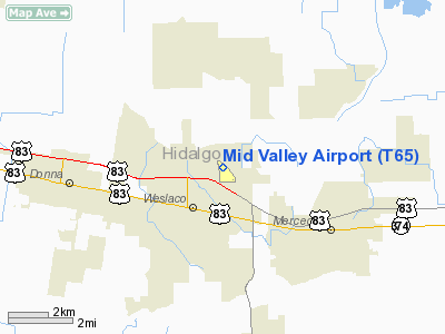
Location & QuickFacts
| FAA Information Effective: | 2008-09-25 |
| Airport Identifier: | T65 |
| Airport Status: | Operational |
| Longitude/Latitude: | 097-58-23.0000W/26-10-39.5000N
-97.973056/26.177639 (Estimated) |
| Elevation: | 70 ft / 21.34 m (Estimated) |
| Land: | 170 acres |
| From nearest city: | 2 nautical miles NE of Weslaco, TX |
| Location: | Hidalgo County, TX |
| Magnetic Variation: | 07E (1985) |
Owner & Manager
| Ownership: | Publicly owned |
| Owner: | City Of Weslaco |
| Address: | 500 Kansas Street
Weslaco, TX 78596 |
| Phone number: | 956-968-3181 |
| Manager: | George Garrett |
| Address: | 1909 Joe Stephens
Weslaco, TX 78596 |
| Phone number: | 956-969-0291 |
Airport Operations and Facilities
| Airport Use: | Open to public |
| Wind indicator: | Yes |
| Segmented Circle: | Yes |
| Control Tower: | No |
| Lighting Schedule: | DUSK-DAWN
MIRL RY 13/31 PRESET LOW INTST; TO INCR INTST ACTVT - CTAF. |
| Beacon Color: | Clear-Green (lighted land airport) |
| Landing fee charge: | No |
| Sectional chart: | Brownsville |
| Region: | ASW - Southwest |
| Boundary ARTCC: | ZHU - Houston |
| Tie-in FSS: | SJT - San Angelo |
| FSS on Airport: | No |
| FSS Toll Free: | 1-800-WX-BRIEF |
| NOTAMs Facility: | T65 (NOTAM-d service avaliable) |
| Federal Agreements: | NGY |
Airport Communications
| CTAF: | 122.800 |
| Unicom: | 122.800 |
Airport Services
| Fuel available: | 100LLA
FUEL SVCS AVBL 24 HRS. |
| Airframe Repair: | MAJOR |
| Power Plant Repair: | MAJOR |
| Bottled Oxygen: | NONE |
| Bulk Oxygen: | NONE |
Runway Information
Runway 13/31
| Dimension: | 4998 x 70 ft / 1523.4 x 21.3 m |
| Surface: | ASPH, Good Condition |
| Weight Limit: | Single wheel: 12500 lbs. |
| Edge Lights: | Medium |
| |
Runway 13 |
Runway 31 |
| Longitude: | 097-58-40.0410W | 097-58-05.9480W |
| Latitude: | 26-10-58.8370N | 26-10-20.0590N |
| Elevation: | 68.00 ft | 69.00 ft |
| Alignment: | 127 | 127 |
| Traffic Pattern: | Left | Right |
| Markings: | Non-precision instrument, Good Condition | Non-precision instrument, Good Condition |
| Crossing Height: | 50.00 ft | 40.00 ft |
| Displaced threshold: | 172.00 ft | 0.00 ft |
| VASI: | 4-light PAPI on left side | 4-light PAPI on left side |
| Visual Glide Angle: | 3.00° | 3.00° |
| Approach lights: | ODALS | |
| Runway End Identifier: | Yes | Yes |
| Obstruction: | 15 ft road, 565.0 ft from runway, 250 ft left of centerline, 24:1 slope to clear
APCH SLOPE 44:1 TO ROAD 672 FT FM DSPLCD THLD 250 FT LEFT OF CNTRLN. | 31 ft pole, 1030.0 ft from runway, 270 ft right of centerline, 26:1 slope to clear |
|
Radio Navigation Aids
| ID |
Type |
Name |
Ch |
Freq |
Var |
Dist |
| SNE | NDB | Santa Elena | | 260.00 | 07E | 46.0 nm |
| REX | VOR | Reynosa | | 112.40 | 08E | 17.1 nm |
| MFE | VOR/DME | Mc Allen | 119X | 117.20 | 09E | 14.4 nm |
| HRL | VOR/DME | Harlingen | 029X | 109.20 | 05E | 17.6 nm |
| MAM | VOR/DME | Matamoros | 090X | 114.30 | 07E | 34.5 nm |
| BRO | VORTAC | Brownsville | 110X | 116.30 | 09E | 35.7 nm |
Images and information placed above are from
http://www.airport-data.com/airport/T65/
We thank them for the data!
| General Info
|
| Country |
United States
|
| State |
TEXAS
|
| FAA ID |
T65
|
| Latitude |
26-10-39.500N
|
| Longitude |
097-58-23.000W
|
| Elevation |
70 feet
|
| Near City |
WESLACO
|
We don't guarantee the information is fresh and accurate. The data may
be wrong or outdated.
For more up-to-date information please refer to other sources.
|
|


