 |
|
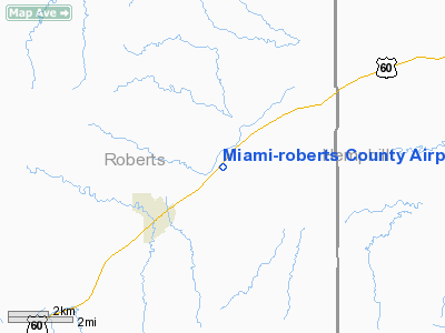
Miami-roberts County Airport |
Location & QuickFacts
| FAA Information Effective: | 2008-09-25 |
| Airport Identifier: | 3E0 |
| Airport Status: | Operational |
| Longitude/Latitude: | 100-36-11.4920W/35-42-50.1560N
-100.603192/35.713932 (Estimated) |
| Elevation: | 2720 ft / 829.06 m (Estimated) |
| Land: | 40 acres |
| From nearest city: | 3 nautical miles NE of Miami, TX |
| Location: | Roberts County, TX |
| Magnetic Variation: | 08E (1985) |
Owner & Manager
| Ownership: | Publicly owned |
| Owner: | County Of Roberts |
| Address: | Box 478
Miami, TX 79059 |
| Phone number: | 806-868-3721 |
| Manager: | Vernon H Cook
COUNTY JUDGE. |
| Address: | Box 478
Miami, TX 79059 |
| Phone number: | 806-868-3721 |
Airport Operations and Facilities
| Airport Use: | Open to public |
| Wind indicator: | Yes |
| Segmented Circle: | Yes |
| Control Tower: | No |
| Lighting Schedule: | DUSK-DAWN
ACTVT LIRL RY 02/20 - CTAF. |
| Beacon Color: | Clear-Green (lighted land airport) |
| Landing fee charge: | No |
| Sectional chart: | Dallas-ft Worth |
| Region: | ASW - Southwest |
| Boundary ARTCC: | ZAB - Albuquerque |
| Tie-in FSS: | FTW - Fort Worth |
| FSS on Airport: | No |
| FSS Phone: | 817-541-3474 |
| FSS Toll Free: | 1-800-WX-BRIEF |
| NOTAMs Facility: | FTW (NOTAM-d service avaliable) |
Airport Communications
Airport Services
| Airframe Repair: | NONE |
| Power Plant Repair: | NONE |
| Bottled Oxygen: | NONE |
| Bulk Oxygen: | NONE |
Runway Information
Runway 02/20
| Dimension: | 4060 x 50 ft / 1237.5 x 15.2 m |
| Surface: | ASPH, Fair Condition |
| Weight Limit: | Single wheel: 12500 lbs. |
| Edge Lights: | Low |
| |
Runway 02 |
Runway 20 |
| Traffic Pattern: | Left | Right |
| Markings: | Basic, Fair Condition | Basic, Fair Condition |
| Displaced threshold: | 0.00 ft | 390.00 ft |
| Obstruction: | 40 ft tree, 637.0 ft from runway, 100 ft right of centerline, 10:1 slope to clear
+15 FT TREE 110 FT LEFT TO LEFT CNTRLN RY 02; 6 FT TREE 180 FT OB.
+4 FT FENCE 100 FT R OF CNTRLN AT THLD. | 8 ft fence, 200.0 ft from runway, 15 ft right of centerline
+8' FENCE 40' RIGHT OF CNTRLN.
APCH RATIO 0:1 FM DSPLCD THLD; +15 FT HILL 90 FT L OF CNTRLN AT DSPLCD THLD.
+8 FT FENCE AT THLD 100 FT L OF CNTRLN AT THLD. |
|
Radio Navigation Aids
| ID |
Type |
Name |
Ch |
Freq |
Var |
Dist |
| HHF | NDB | Hemphill County | | 400.00 | 08E | 14.4 nm |
| PPA | NDB | Pampa | | 368.00 | 09E | 19.9 nm |
| PYX | NDB | Perryton | | 266.00 | 09E | 42.6 nm |
| BGD | VORTAC | Borger | 023X | 108.60 | 11E | 38.4 nm |
Remarks
- +30' LIGHT POLE AT WIND CONE OBSTRUCTS PRIMARY SFC.
Images and information placed above are from
http://www.airport-data.com/airport/3E0/
We thank them for the data!
| General Info
|
| Country |
United States
|
| State |
TEXAS
|
| FAA ID |
3E0
|
| Latitude |
35-42-50.156N
|
| Longitude |
100-36-11.492W
|
| Elevation |
2720 feet
|
| Near City |
MIAMI
|
We don't guarantee the information is fresh and accurate. The data may
be wrong or outdated.
For more up-to-date information please refer to other sources.
|
|


