 |
|
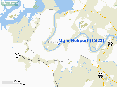
Location & QuickFacts
| FAA Information Effective: | 2008-09-25 |
| Airport Identifier: | TS23 |
| Airport Status: | Operational |
| Longitude/Latitude: | 097-54-22.0300W/30-20-14.7300N
-97.906119/30.337425 (Estimated) |
| Elevation: | 540 ft / 164.59 m (Estimated) |
| Land: | 0 acres |
| From nearest city: | 15 nautical miles NW of Austin, TX |
| Location: | Travis County, TX |
| Magnetic Variation: | 06E (2000) |
Owner & Manager
| Ownership: | Privately owned |
| Owner: | Mgm Holdings Inc |
| Address: | 12021 Selma Hughes Park Road
Austin, TX 78759 |
| Phone number: | 512-266-1011 |
| Manager: | Michael Mccarthy |
| Address: | 12021 Selma Hughes Park Road
Austin, TX 78759 |
| Phone number: | 512-266-1011 |
Airport Operations and Facilities
| Airport Use: | Private |
| Wind indicator: | Yes |
| Segmented Circle: | No |
| Control Tower: | No |
| Sectional chart: | San Antonio |
| Region: | ASW - Southwest |
| Boundary ARTCC: | ZHU - Houston |
| Tie-in FSS: | SJT - San Angelo |
| FSS Toll Free: | 1-800-WX-BRIEF |
Runway Information
Helipad H1
| Dimension: | 100 x 100 ft / 30.5 x 30.5 m |
| Surface: | CONC, |
| |
Runway H1 |
Runway |
| Traffic Pattern: | Left | Left |
|
Radio Navigation Aids
| ID |
Type |
Name |
Ch |
Freq |
Var |
Dist |
| GUO | NDB | Georgetown | | 332.00 | 06E | 23.9 nm |
| MFS | NDB | Horseshoe Bay Resort | | 403.00 | 07E | 25.9 nm |
| BMQ | NDB | Burnet | | 341.00 | 07E | 29.6 nm |
| IL | NDB | Iresh | | 278.00 | 07E | 42.5 nm |
| HLR | NDB | Hood | | 347.00 | 07E | 48.6 nm |
| GYB | NDB | Lee County | | 385.00 | 07E | 49.2 nm |
| GR | NDB | Starn | | 323.00 | 07E | 49.9 nm |
| GRK | VOR/DME | Gray | 055X | 111.80 | 07E | 42.1 nm |
| CWK | VORTAC | Centex | 075X | 112.80 | 06E | 19.7 nm |
| STV | VORTAC | Stonewall | 085X | 113.80 | 08E | 42.2 nm |
Images and information placed above are from
http://www.airport-data.com/airport/TS23/
We thank them for the data!
| General Info
|
| Country |
United States
|
| State |
TEXAS
|
| FAA ID |
TS23
|
| Latitude |
30-20-14.730N
|
| Longitude |
097-54-22.030W
|
| Elevation |
540 feet
|
| Near City |
AUSTIN
|
We don't guarantee the information is fresh and accurate. The data may
be wrong or outdated.
For more up-to-date information please refer to other sources.
|
|


