 |
|
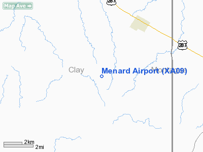
Location & QuickFacts
| FAA Information Effective: | 2008-09-25 |
| Airport Identifier: | XA09 |
| Airport Status: | Operational |
| Longitude/Latitude: | 098-03-40.0000W/33-34-55.0000N
-98.061111/33.581944 (Estimated) |
| Elevation: | 1055 ft / 321.56 m (Estimated) |
| Land: | 60 acres |
| From nearest city: | 4 nautical miles SW of Bellevue, TX |
| Location: | Clay County, TX |
| Magnetic Variation: | () |
Owner & Manager
| Ownership: | Privately owned |
| Owner: | Keith Menard |
| Address: | 2170 B Davis Rd
Bellevue, TX 76228 |
| Phone number: | 940-841-0128 |
| Manager: | Keith Menard |
| Address: | 2170 B Davis Rd
Bellevue, TX 76228 |
| Phone number: | 940-928-2238 |
Airport Operations and Facilities
| Airport Use: | Private |
| Wind indicator: | Yes |
| Segmented Circle: | No |
| Control Tower: | No |
| Sectional chart: | Dallas-ft Worth |
| Region: | ASW - Southwest |
| Boundary ARTCC: | ZFW - Fort Worth |
| Tie-in FSS: | FTW - Fort Worth |
| FSS Phone: | 817-541-3474 |
| FSS Toll Free: | 1-800-WX-BRIEF |
Runway Information
Runway 18/36
| Dimension: | 3000 x 80 ft / 914.4 x 24.4 m |
| Surface: | TURF, |
| |
Runway 18 |
Runway 36 |
| Traffic Pattern: | Left | Left |
| Obstruction: | 25 ft pline, 4000.0 ft from runway | 20 ft pline, 100.0 ft from runway |
|
Radio Navigation Aids
| ID |
Type |
Name |
Ch |
Freq |
Var |
Dist |
| GMZ | NDB | Grindstone Mountain | | 356.00 | 07E | 14.5 nm |
| SKB | NDB | Scotland | | 344.00 | 08E | 24.7 nm |
| GHX | NDB | Graham | | 371.00 | 07E | 33.2 nm |
| ONY | NDB | Olney | | 272.00 | 07E | 40.3 nm |
| GZV | NDB | Brazos River | | 280.00 | 07E | 41.8 nm |
| GLE | NDB | Gainesville | | 330.00 | 06E | 43.9 nm |
| MWL | NDB | Mineral Wells | | 266.00 | 06E | 47.9 nm |
| SHP | TACAN | Sheppard | 045X | | 10E | 32.2 nm |
| DUC | VOR/DME | Duncan | 047X | 111.00 | 09E | 48.8 nm |
| UKW | VORTAC | Bowie | 071X | 112.40 | 06E | 12.3 nm |
| SPS | VORTAC | Wichita Falls | 074X | 112.70 | 10E | 36.1 nm |
Remarks
- PRVDD ORANGE BALLS OR LGTS PLACED ON PLINES SOUTH & NORTH OF RY & VERIFY LAT/LONG.
Images and information placed above are from
http://www.airport-data.com/airport/XA09/
We thank them for the data!
|
|


