 |
|
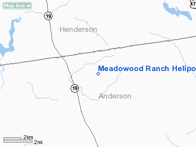
Location & QuickFacts
| FAA Information Effective: | 2008-09-25 |
| Airport Identifier: | 01XS |
| Airport Status: | Operational |
| Longitude/Latitude: | 095-44-43.8610W/32-01-12.5770N
-95.745517/32.020160 (Estimated) |
| Elevation: | 500 ft / 152.40 m (Estimated) |
| Land: | 1 acres |
| From nearest city: | 15 nautical miles SE of Athens, TX |
| Location: | Anderson County, TX |
| Magnetic Variation: | 06E (1985) |
Owner & Manager
| Ownership: | Privately owned |
| Owner: | U S Companies Inc |
| Address: | 5950 Berkshire La, Suite 300
Dallas, TX 75225 |
| Phone number: | 214-248-1870 |
| Manager: | Max Williams |
| Address: | 5950 Berkshire, Suite 300
Dallas, TX 75225 |
| Phone number: | 214-891-3300 |
Airport Operations and Facilities
| Airport Use: | Private |
| Wind indicator: | Yes |
| Segmented Circle: | No |
| Control Tower: | No |
| Lighting Schedule: | RDO-CTL
ACTIVATE ROTG BCN - 122.85. |
| Beacon Color: | Clear-Green (lighted land airport) |
| Sectional chart: | Dallas-ft Worth |
| Region: | ASW - Southwest |
| Boundary ARTCC: | ZFW - Fort Worth |
| Tie-in FSS: | FTW - Fort Worth |
| FSS Phone: | 817-541-3474 |
| FSS Toll Free: | 1-800-WX-BRIEF |
Runway Information
Helipad H1
| Dimension: | 50 x 50 ft / 15.2 x 15.2 m
50X50' TD WITH A 300X150' LANDING/TKOF AREA. |
| Surface: | CONC, |
| |
Runway H1 |
Runway |
| Traffic Pattern: | Left | Left |
|
Radio Navigation Aids
| ID |
Type |
Name |
Ch |
Freq |
Var |
Dist |
| AHX | NDB | Athens | | 269.00 | 06E | 9.4 nm |
| LIQ | NDB | Lochridge Ranch | | 335.00 | 09E | 10.6 nm |
| CSZ | NDB | Crossroads | | 215.00 | 08E | 11.1 nm |
| PSN | NDB | Palestine | | 375.00 | 04E | 14.6 nm |
| PYF | NDB | Pyramid | | 418.00 | 06E | 24.9 nm |
| TY | NDB | Tyler | | 320.00 | 06E | 27.6 nm |
| JSO | NDB | Cherokee County | | 263.00 | 05E | 28.5 nm |
| CRS | NDB | Corsicana | | 396.00 | 06E | 33.1 nm |
| CGQ | NDB | Powell | | 344.00 | 06E | 34.9 nm |
| LXY | NDB | Mexia | | 329.00 | 07E | 45.3 nm |
| HNO | NDB | Henderson | | 371.00 | 06E | 46.1 nm |
| ABG | NDB | Ambassador | | 404.00 | 07E | 46.8 nm |
| FZT | VOR/DME | Frankston | 051X | 111.40 | 06E | 11.4 nm |
| TYR | VOR/DME | Tyler | 089X | 114.20 | 06E | 26.6 nm |
| GNL | VOR/DME | Groesbeck | 025X | 108.80 | 05E | 48.8 nm |
| CQY | VORTAC | Cedar Creek | 095X | 114.80 | 06E | 26.0 nm |
Remarks
Images and information placed above are from
http://www.airport-data.com/airport/01XS/
We thank them for the data!
| General Info
|
| Country |
United States
|
| State |
TEXAS
|
| FAA ID |
01XS
|
| Latitude |
32-01-12.577N
|
| Longitude |
095-44-43.861W
|
| Elevation |
500 feet
|
| Near City |
ATHENS
|
We don't guarantee the information is fresh and accurate. The data may
be wrong or outdated.
For more up-to-date information please refer to other sources.
|
|


