 |
|
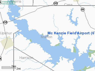
Location & QuickFacts
| FAA Information Effective: | 2008-09-25 |
| Airport Identifier: | 6TE9 |
| Airport Status: | Operational |
| Longitude/Latitude: | 094-37-00.7320W/32-49-00.4880N
-94.616870/32.816802 (Estimated) |
| Elevation: | 360 ft / 109.73 m (Estimated) |
| Land: | 30 acres |
| From nearest city: | 6 nautical miles SW of Avinger, TX |
| Location: | Marion County, TX |
| Magnetic Variation: | 05E (1985) |
Owner & Manager
| Ownership: | Privately owned |
| Owner: | Fred A. Mc Kenzie |
| Address: | Rt 1, Box 404
Avinger, TX 75630 |
| Phone number: | 903-755-2240 |
| Manager: | Fred A. Mc Kenzie |
| Address: | Rt 1, Box 404
Avinger, TX 75630 |
| Phone number: | 903-755-2240 |
Airport Operations and Facilities
| Airport Use: | Private |
| Segmented Circle: | No |
| Control Tower: | No |
| Landing fee charge: | Yes |
| Sectional chart: | Memphis |
| Region: | ASW - Southwest |
| Boundary ARTCC: | ZFW - Fort Worth |
| Tie-in FSS: | FTW - Fort Worth |
| FSS on Airport: | No |
| FSS Phone: | 817-541-3474 |
| FSS Toll Free: | 1-800-WX-BRIEF
LONG DISTANCE CALL TO FSS 817-429-6434. |
Airport Services
| Airframe Repair: | NONE |
| Power Plant Repair: | NONE |
Runway Information
Runway 09/27
| Dimension: | 2840 x 35 ft / 865.6 x 10.7 m |
| Surface: | TURF, Fair Condition |
| |
Runway 09 |
Runway 27 |
| Traffic Pattern: | Left | Left |
| Obstruction: | 15 ft bldg, 50 ft left of centerline | 40 ft tree, 0.0 ft from runway, 50 ft left of centerline |
|
Radio Navigation Aids
| ID |
Type |
Name |
Ch |
Freq |
Var |
Dist |
| LST | NDB | Lone Star | | 305.00 | 05E | 9.2 nm |
| ATA | NDB | Atlanta | | 347.00 | 04E | 27.6 nm |
| ABG | NDB | Ambassador | | 404.00 | 07E | 28.7 nm |
| VIV | NDB | Vivian | | 284.00 | 06E | 30.7 nm |
| HNO | NDB | Henderson | | 371.00 | 06E | 39.8 nm |
| RPF | NDB | Carthage | | 332.00 | 04E | 41.6 nm |
| TY | NDB | Tyler | | 320.00 | 06E | 49.4 nm |
| DTN | VOR | Downtown | | 108.60 | 07E | 47.3 nm |
| UIM | VOR/DME | Quitman | 087X | 114.00 | 08E | 38.1 nm |
| TYR | VOR/DME | Tyler | 089X | 114.20 | 06E | 48.5 nm |
| GGG | VORTAC | Gregg County | 070X | 112.30 | 07E | 25.0 nm |
| EIC | VORTAC | Belcher | 121X | 117.40 | 07E | 40.9 nm |
| SHV | VOT | Shreveport Regional | | 108.20 | | 41.3 nm |
Remarks
Images and information placed above are from
http://www.airport-data.com/airport/6TE9/
We thank them for the data!
| General Info
|
| Country |
United States
|
| State |
TEXAS
|
| FAA ID |
6TE9
|
| Latitude |
32-49-00.488N
|
| Longitude |
094-37-00.732W
|
| Elevation |
360 feet
|
| Near City |
AVINGER
|
We don't guarantee the information is fresh and accurate. The data may
be wrong or outdated.
For more up-to-date information please refer to other sources.
|
|


