 |
|
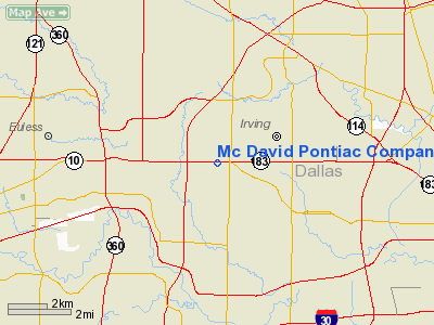
Mc David Pontiac Company Heliport |
Location & QuickFacts
| FAA Information Effective: | 2008-09-25 |
| Airport Identifier: | TE31 |
| Airport Status: | Operational |
| Longitude/Latitude: | 097-00-00.0250W/32-50-10.4610N
-97.000007/32.836239 (Estimated) |
| Elevation: | 510 ft / 155.45 m (Estimated) |
| Land: | 0 acres |
| From nearest city: | 3 nautical miles W of Irving, TX |
| Location: | Dallas County, TX |
| Magnetic Variation: | 07E (1985) |
Owner & Manager
| Ownership: | Privately owned |
| Owner: | David Mc David Pontiac, Inc. |
| Address: | P.o. Box 165347
Irving, TX 75016 |
| Phone number: | 214-790-6000 |
| Manager: | Thomas E Taylor |
| Address: | 4201 N. Main 23n
Ft. Worth, TX 76106 |
| Phone number: | 817-625-7234 |
Airport Operations and Facilities
| Airport Use: | Private |
| Wind indicator: | Yes |
| Segmented Circle: | No |
| Control Tower: | No |
| Sectional chart: | Dallas-ft Worth |
| Region: | ASW - Southwest |
| Boundary ARTCC: | ZFW - Fort Worth |
| Tie-in FSS: | FTW - Fort Worth |
| FSS Phone: | 817-541-3474 |
| FSS Toll Free: | 1-800-WX-BRIEF |
Runway Information
Helipad H1
| Dimension: | 30 x 30 ft / 9.1 x 9.1 m |
| Surface: | ASPH,
ROOFTOP |
| |
Runway H1 |
Runway |
| Traffic Pattern: | Left | Left |
|
Radio Navigation Aids
| ID |
Type |
Name |
Ch |
Freq |
Var |
Dist |
| RBD | NDB | Redbird | | 287.00 | 06E | 11.6 nm |
| XQH | NDB | Cedar Hill | | 353.00 | 08E | 14.8 nm |
| LNC | NDB | Lancaster | | 239.00 | 06E | 21.0 nm |
| PQF | NDB | Mesquite | | 248.00 | 06E | 23.8 nm |
| JUG | NDB | Jecca | | 388.00 | 06E | 25.7 nm |
| AVZ | NDB | Travis | | 260.00 | 06E | 38.2 nm |
| MII | NDB | Caddo Mills | | 316.00 | 06E | 39.8 nm |
| SYW | NDB | Cash | | 428.00 | 05E | 47.9 nm |
| NFW | TACAN | Nas Jrb Fort Worth | 024X | | 07E | 22.5 nm |
| MJF | TACAN | Arvilla | 033X | | 05E | 49.3 nm |
| TTT | VOR/DME | Maverick | 078X | 113.10 | 06E | 2.8 nm |
| CVE | VOR/DME | Cowboy | 109X | 116.20 | 06E | 5.8 nm |
| FUZ | VORTAC | Ranger | 104X | 115.70 | 06E | 9.6 nm |
| DAL | VOT | Dallas Love Field | | 113.30 | | 7.5 nm |
| FTW | VOT | Fort Worth Meacham | | 108.20 | | 18.1 nm |
Remarks
- PRVDD VFR; WIND INDICATOR INSTALLED; PRIOR TO COMMENCING OPERATIONS CONTACT IS MADE W/DALLAS/FT. WORTH ATCT TO ESTABLISH HELIPORT PROCEDURES
Images and information placed above are from
http://www.airport-data.com/airport/TE31/
We thank them for the data!
| General Info
|
| Country |
United States
|
| State |
TEXAS
|
| FAA ID |
TE31
|
| Latitude |
32-50-10.461N
|
| Longitude |
097-00-00.025W
|
| Elevation |
510 feet
|
| Near City |
IRVING
|
We don't guarantee the information is fresh and accurate. The data may
be wrong or outdated.
For more up-to-date information please refer to other sources.
|
|


