 |
|
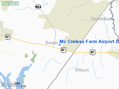
Location & QuickFacts
| FAA Information Effective: | 2008-09-25 |
| Airport Identifier: | 3TX5 |
| Airport Status: | Operational |
| Longitude/Latitude: | 098-13-54.0370W/29-22-15.8490N
-98.231677/29.371069 (Estimated) |
| Elevation: | 600 ft / 182.88 m (Estimated) |
| Land: | 42 acres |
| From nearest city: | 2 nautical miles SE of Adkins, TX |
| Location: | Bexar County, TX |
| Magnetic Variation: | 07E (1990) |
Owner & Manager
| Ownership: | Privately owned |
| Owner: | Glen D. Mc Creless, M.d. |
| Address: | 4037 E. Southcross
San Antonio, TX 78220 |
| Phone number: | 512-337-4921 |
| Manager: | Glen D. Mc Creless, M.d. |
| Address: | 5505 Pittman Rd
Adkins, TX 78101 |
Airport Operations and Facilities
| Airport Use: | Private |
| Segmented Circle: | No |
| Control Tower: | No |
| Sectional chart: | San Antonio |
| Region: | ASW - Southwest |
| Boundary ARTCC: | ZHU - Houston |
| Tie-in FSS: | SJT - San Angelo |
| FSS on Airport: | No |
| FSS Toll Free: | 1-800-WX-BRIEF |
Runway Information
Runway E/W
| Dimension: | 2200 x 150 ft / 670.6 x 45.7 m |
| Surface: | TURF, |
| |
Runway E |
Runway W |
| Traffic Pattern: | Left | Left |
|
Radio Navigation Aids
| ID |
Type |
Name |
Ch |
Freq |
Var |
Dist |
| PEZ | NDB | Pleasanton | | 275.00 | 07E | 29.2 nm |
| CVB | NDB | Castroville | | 338.00 | 08E | 32.4 nm |
| HHH | NDB | Devine | | 359.00 | 07E | 39.7 nm |
| HMA | NDB | Hondo | | 329.00 | 08E | 49.3 nm |
| DHK | TACAN | Randolph | 036X | | 09E | 10.1 nm |
| KSY | TACAN | Kelly | 057X | | 07E | 18.3 nm |
| SSF | VOR | Stinson | | 108.40 | 09E | 13.0 nm |
| HDO | VOR/DME | Hondo | 31X | 109.40 | 08E | 49.6 nm |
| RND | VORTAC | Randolph | 70X | 112.30 | 09E | 9.3 nm |
| SAT | VORTAC | San Antonio | 115X | 116.80 | 08E | 20.3 nm |
| SAT | VOT | San Antonio Intl | | 110.40 | | 15.8 nm |
Images and information placed above are from
http://www.airport-data.com/airport/3TX5/
We thank them for the data!
| General Info
|
| Country |
United States
|
| State |
TEXAS
|
| FAA ID |
3TX5
|
| Latitude |
29-22-15.849N
|
| Longitude |
098-13-54.037W
|
| Elevation |
600 feet
|
| Near City |
ADKINS
|
We don't guarantee the information is fresh and accurate. The data may
be wrong or outdated.
For more up-to-date information please refer to other sources.
|
|


