 |
|
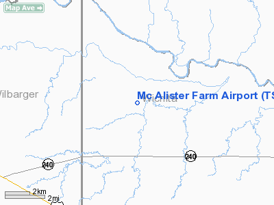
Location & QuickFacts
| FAA Information Effective: | 2008-09-25 |
| Airport Identifier: | TS80 |
| Airport Status: | Operational |
| Longitude/Latitude: | 098-54-11.2500W/34-07-50.3250N
-98.903125/34.130646 (Estimated) |
| Elevation: | 1125 ft / 342.90 m (Estimated) |
| Land: | 0 acres |
| From nearest city: | 8 nautical miles S of Electra, TX |
| Location: | Wichita County, TX |
| Magnetic Variation: | 08E (1985) |
Owner & Manager
| Ownership: | Privately owned |
| Owner: | A. L. Mc Alister |
| Address: | 11631 Oakwood Lane
Fort Worth, TX 76179-9217 |
| Phone number: | 817-236-4004 |
| Address: |
|
Airport Operations and Facilities
| Airport Use: | Private |
| Segmented Circle: | No |
| Control Tower: | No |
| Landing fee charge: | Yes |
| Sectional chart: | Dallas-ft Worth |
| Region: | ASW - Southwest |
| Boundary ARTCC: | ZFW - Fort Worth |
| Tie-in FSS: | FTW - Fort Worth |
| FSS on Airport: | No |
| FSS Phone: | 817-541-3474 |
| FSS Toll Free: | 1-800-WX-BRIEF |
Runway Information
Runway 17L/35R
| Dimension: | 2400 x 75 ft / 731.5 x 22.9 m |
| Surface: | TURF, |
| |
Runway 17L |
Runway 35R |
| Traffic Pattern: | Left | Left |
|
Runway 17R/35L
| Dimension: | 2600 x 50 ft / 792.5 x 15.2 m |
| Surface: | TURF, |
| |
Runway 17R |
Runway 35L |
| Traffic Pattern: | Left | Left |
|
Radio Navigation Aids
| ID |
Type |
Name |
Ch |
Freq |
Var |
Dist |
| FSI | FAN MARKER | Trail | | | 09E | 46.3 nm |
| VRT | NDB | Wilbarger | | 230.00 | 08E | 19.6 nm |
| SKB | NDB | Scotland | | 344.00 | 08E | 29.2 nm |
| PFL | NDB | Post | | 308.00 | 08E | 37.9 nm |
| OFZ | NDB | Trail | | 388.00 | 09E | 46.3 nm |
| ONY | NDB | Olney | | 272.00 | 07E | 47.1 nm |
| SHP | TACAN | Sheppard | 045X | | 10E | 22.5 nm |
| LAW | VOR/DME | Lawton | 031X | 109.40 | 09E | 32.8 nm |
| SPS | VORTAC | Wichita Falls | 074X | 112.70 | 10E | 17.7 nm |
| LTS | VORTAC | Altus | 035X | 109.80 | 08E | 36.8 nm |
| HBR | VORTAC | Hobart | 055X | 111.80 | 10E | 44.9 nm |
Images and information placed above are from
http://www.airport-data.com/airport/TS80/
We thank them for the data!
| General Info
|
| Country |
United States
|
| State |
TEXAS
|
| FAA ID |
TS80
|
| Latitude |
34-07-50.325N
|
| Longitude |
098-54-11.250W
|
| Elevation |
1125 feet
|
| Near City |
ELECTRA
|
We don't guarantee the information is fresh and accurate. The data may
be wrong or outdated.
For more up-to-date information please refer to other sources.
|
|


