 |
|
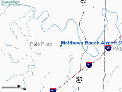
Location & QuickFacts
| FAA Information Effective: | 2008-09-25 |
| Airport Identifier: | 86TE |
| Airport Status: | Operational |
| Longitude/Latitude: | 098-08-50.1500W/32-38-59.4700N
-98.147264/32.649853 (Estimated) |
| Elevation: | 835 ft / 254.51 m (Estimated) |
| Land: | 0 acres |
| From nearest city: | 5 nautical miles N of Santo, TX |
| Location: | Palo Pinto County, TX |
| Magnetic Variation: | 06E (2000) |
Owner & Manager
| Ownership: | Privately owned |
| Owner: | K R Matthews |
| Address: | 5096 N Fm 129
Santo, TX 76472 |
| Phone number: | 940-769-2121 |
| Manager: | K R Matthews |
| Address: | 5096 N Fm 129
Santo, TX 76472 |
| Phone number: | 940-769-2121 |
Airport Operations and Facilities
| Airport Use: | Private |
| Wind indicator: | Yes |
| Segmented Circle: | No |
| Control Tower: | No |
| Sectional chart: | Dallas-ft Worth |
| Region: | ASW - Southwest |
| Boundary ARTCC: | ZFW - Fort Worth |
| Tie-in FSS: | FTW - Fort Worth |
| FSS Phone: | 817-541-3474 |
| FSS Toll Free: | 1-800-WX-BRIEF |
Runway Information
Runway 07/25
| Dimension: | 2000 x 40 ft / 609.6 x 12.2 m |
| Surface: | TURF, |
| |
Runway 07 |
Runway 25 |
| Traffic Pattern: | Left | Left |
| Obstruction: | 80 ft gnd, 100.0 ft from runway | 40 ft trees, 30.0 ft from runway |
|
Radio Navigation Aids
| ID |
Type |
Name |
Ch |
Freq |
Var |
Dist |
| MWL | NDB | Mineral Wells | | 266.00 | 06E | 9.3 nm |
| GZV | NDB | Brazos River | | 280.00 | 07E | 22.6 nm |
| GHX | NDB | Graham | | 371.00 | 07E | 35.7 nm |
| OIP | NDB | Old Rip | | 410.00 | 07E | 36.8 nm |
| BKD | NDB | Breckenridge | | 245.00 | 07E | 38.1 nm |
| NFW | TACAN | Nas Jrb Fort Worth | 024X | | 07E | 36.5 nm |
| MQP | VORTAC | Millsap | 124X | 117.70 | 09E | 8.9 nm |
| JEN | VORTAC | Glen Rose | 097X | 115.00 | 06E | 32.5 nm |
| FTW | VOT | Fort Worth Meacham | | 108.20 | | 41.1 nm |
Remarks
- PRVDD POWER LINES ON EAST SIDE OF RY REMOVED OR MKD.
Images and information placed above are from
http://www.airport-data.com/airport/86TE/
We thank them for the data!
|
|


