 |
|
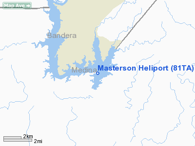
Location & QuickFacts
| FAA Information Effective: | 2008-09-25 |
| Airport Identifier: | 81TA |
| Airport Status: | Operational |
| Longitude/Latitude: | 098-55-46.1060W/29-33-23.8240N
-98.929474/29.556618 (Estimated) |
| Elevation: | 1100 ft / 335.28 m (Estimated) |
| Land: | 1 acres |
| From nearest city: | 1 nautical miles NW of Mico, TX |
| Location: | Medina County, TX |
| Magnetic Variation: | 07E (1990) |
Owner & Manager
| Ownership: | Privately owned |
| Owner: | John C. Lasher |
| Address: | 784 Cr 262
Mico, TX 78056-5209 |
| Phone number: | 210-612-3752 |
| Manager: | John C. Lasher |
| Address: | 784 Cr 262
Mico, TX 78056-5209 |
| Phone number: | 210-612-3752 |
Airport Operations and Facilities
| Airport Use: | Private |
| Wind indicator: | Yes |
| Segmented Circle: | No |
| Control Tower: | No |
| Lighting Schedule: | PHONE REQ
FOR PERIMETER LGTS CALL 210-612-3752 |
| Sectional chart: | San Antonio |
| Region: | ASW - Southwest |
| Boundary ARTCC: | ZHU - Houston |
| Tie-in FSS: | SJT - San Angelo |
| FSS on Airport: | No |
| FSS Toll Free: | 1-800-WX-BRIEF |
Airport Services
Runway Information
Helipad H1
| Dimension: | 12 x 12 ft / 3.7 x 3.7 m |
| Surface: | CONC, |
| |
Runway H1 |
Runway |
| Traffic Pattern: | Left | Left |
|
Radio Navigation Aids
| ID |
Type |
Name |
Ch |
Freq |
Var |
Dist |
| CVB | NDB | Castroville | | 338.00 | 08E | 13.3 nm |
| HMA | NDB | Hondo | | 329.00 | 08E | 16.8 nm |
| ER | NDB | Shein | | 263.00 | 08E | 21.9 nm |
| HHH | NDB | Devine | | 359.00 | 07E | 25.1 nm |
| PEZ | NDB | Pleasanton | | 275.00 | 07E | 42.1 nm |
| UVA | NDB | Uvalde | | 281.00 | 07E | 47.5 nm |
| KSY | TACAN | Kelly | 057X | | 07E | 20.8 nm |
| DHK | TACAN | Randolph | 036X | | 09E | 34.6 nm |
| SSF | VOR | Stinson | | 108.40 | 09E | 31.1 nm |
| HDO | VOR/DME | Hondo | 31X | 109.40 | 08E | 18.0 nm |
| SAT | VORTAC | San Antonio | 115X | 116.80 | 08E | 25.0 nm |
| CSI | VORTAC | Center Point | 122X | 117.50 | 08E | 26.5 nm |
| RND | VORTAC | Randolph | 70X | 112.30 | 09E | 33.8 nm |
| STV | VORTAC | Stonewall | 085X | 113.80 | 08E | 40.8 nm |
| SAT | VOT | San Antonio Intl | | 110.40 | | 24.1 nm |
Images and information placed above are from
http://www.airport-data.com/airport/81TA/
We thank them for the data!
| General Info
|
| Country |
United States
|
| State |
TEXAS
|
| FAA ID |
81TA
|
| Latitude |
29-33-23.824N
|
| Longitude |
098-55-46.106W
|
| Elevation |
1100 feet
|
| Near City |
MICO
|
We don't guarantee the information is fresh and accurate. The data may
be wrong or outdated.
For more up-to-date information please refer to other sources.
|
|


